


DELMARVA - A cool, damp pattern will continue across Sussex County early Friday as northeast winds and clouds keep temperatures well below recent levels.
Scattered showers may linger early Friday morning before rain chances increase again later in the day. Forecasters said high pressure building to the north and a front stalled to the south will help keep a chilly onshore flow in place.
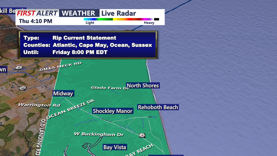
Along the Delaware beaches, conditions will be dangerous Friday. East-northeast winds are expected to increase to 15 to 20 mph, with gusts of 25 to 30 mph. Seas will build to 4 to 6 feet, with breaking waves of 2 to 4 feet.
A high risk of rip currents is expected along the Delaware coast. Cold ocean water temperatures, mainly in the 50s to low 60s, could quickly lead to hypothermia or physical incapacitation for anyone who enters the water.
Rain is expected to become more widespread Friday night as showers spread northward across the region. Rainfall through Friday night is expected to total about one-tenth to one-half inch.
By Saturday morning, steadier rain is expected to develop across Sussex County as low pressure approaches from the west. The setup will keep temperatures chilly, with an onshore breeze continuing through the morning.
Heavier rain is possible at times Saturday, though the risk of thunder remains low. Total rainfall from Saturday into Sunday could reach 1 to 2 inches, bringing needed rain to a region still dealing with long-term drought conditions.
