


DELMARVA -- A series of low-pressure systems moving across the East Coast will make for a stormy stretch across Delmarva through the end of the week.

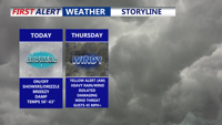
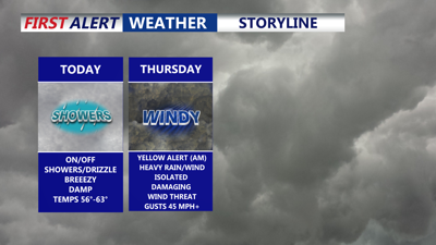
On and off showers, highs around 60. Gusts to 35 mph out of the northeast.
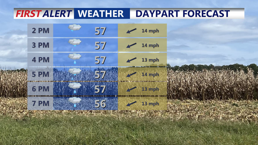
Today, moisture from a low-pressure system along the Carolina coast will bring on-and-off drizzle and scattered showers under low clouds. Temperatures will stay cool, topping out in the upper 50s to near 60 degrees. Northeasterly winds of 10 to 20 mph will continue, with gusts reaching 30 to 35 mph at times.
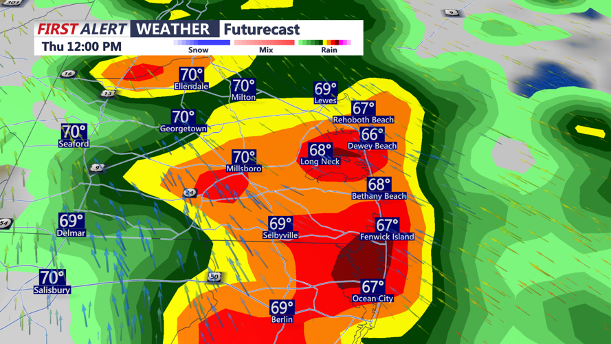
By Wednesday night, a stronger storm system will take shape as low pressure over the Tennessee Valley merges with a coastal low off the Outer Banks. The system is expected to track northeast into the Delmarva region overnight and into Thursday, bringing widespread moderate to heavy rainfall and strong easterly winds.

Gusts out the east will approach 45 to 50 mph out of the east.
Rainfall totals between one and two inches are likely by Thursday evening, with localized areas seeing up to three inches. Although flooding is not expected to be widespread due to recent dry conditions, poor drainage and urban flooding could occur in low-lying areas. The rain may also turn convective at times, leading to isolated thunderstorms.

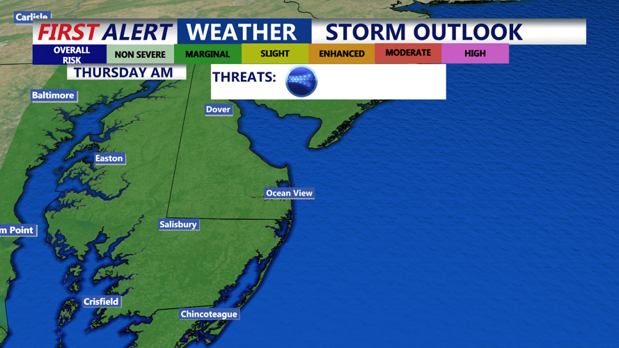
Marginal risk (1 of 5) for an isolated severe storm, primary threat would be damaging wind gusts 55 mph +
The Storm Prediction Center has placed the entire Delmarva Peninsula under a marginal risk for severe weather Thursday, meaning an isolated severe storm with damaging winds exceeding 55 mph is possible. Even outside of storms, winds could gust between 40 and 50 mph along the coast.

Heavy rain and a rumble of thunder overnight into Thursday.
Conditions will gradually improve late Thursday night as the low moves offshore. However, the backside of the storm will bring strong westerly winds Friday, with gusts again reaching up to 40 mph. Temperatures will remain in the upper 50s to low 60s, and while skies may clear, the day will stay brisk and blustery for trick or treaters.
High pressure is expected to move in for the weekend, allowing calmer and drier conditions to return to the region. Breezy conditions will persist into Saturday, but winds will gradually ease. Highs in the low 60s. Overnight lows will dip into the low to mid-40s, with the potential for patchy frost in some inland areas by Sunday morning.