


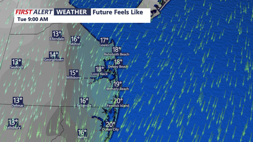


DELMARVA - Sussex County will wake up to frigid conditions early Tuesday morning as an Arctic high remains centered over the Northeast. Morning temperatures will sit in the teens to low twenties across the county, marking another start well below seasonal norms. Light winds will keep wind chills close to actual temperatures.
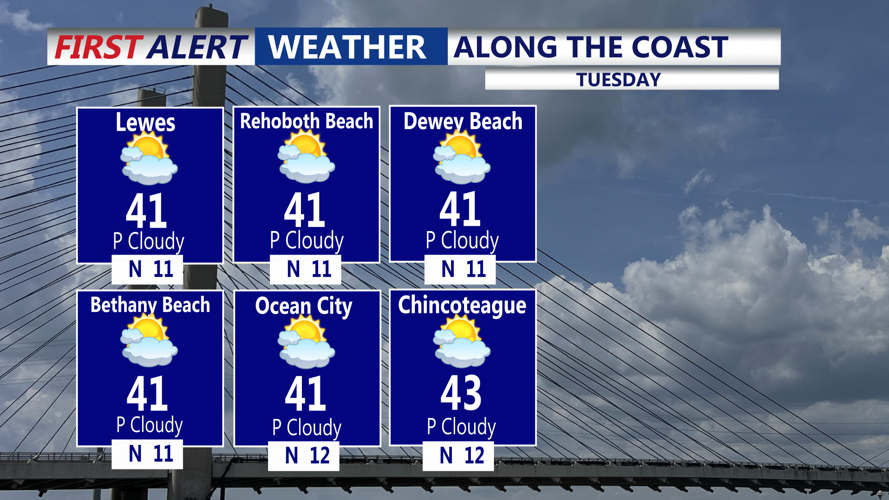
Through the day Tuesday, the high will gradually slide offshore, allowing temperatures to rebound slightly. Highs will reach the mid to upper thirties across Delmarva—still ten to fifteen degrees below normal for this time of year. Skies will remain mostly clear to partly cloudy, and winds will become southerly by late day as return flow develops.
By Tuesday evening, temperatures will fall back into the upper twenties to low thirties before leveling off or slowly rising overnight. Moisture tied to an approaching clipper system will move in after midnight, bringing the first chance of precipitation to Sussex County. With surface temperatures above freezing, the region is expected to see plain rain, while areas north of the I-95 corridor deal with snow or a wintry mix.
Rain will continue into early Wednesday morning before tapering as the system pushes into New England. Temperatures at daybreak Wednesday will hover in the mid to upper thirties, setting the stage for a milder day ahead.