


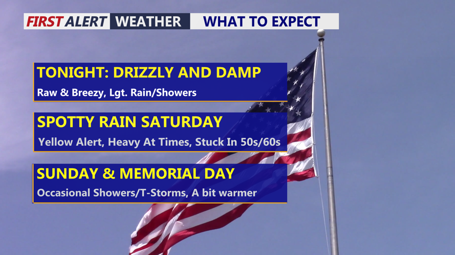


DELMARVA - Sussex County is expected to see a raw and unsettled start to the holiday weekend, with rain, gusty coastal winds and dangerous surf conditions lasting from late Friday night through late Saturday night.
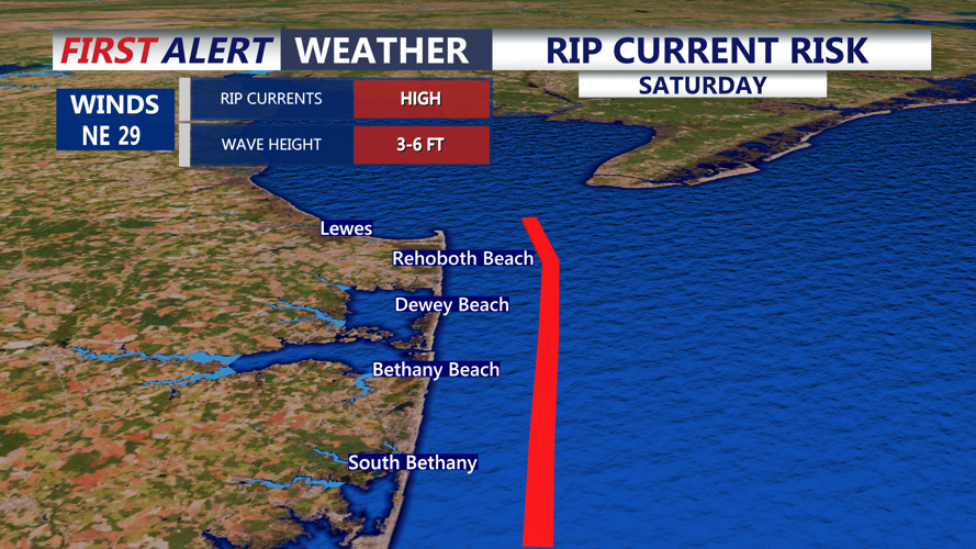
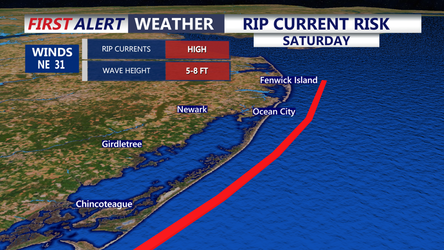
A high surf advisory has been issued for the Delaware beaches from 8 a.m. Saturday to 8 a.m. Sunday. A rip current statement also remains in effect through 8 p.m. Saturday because of a high risk of dangerous rip currents.
Showers developing late Friday night are expected to become more widespread by Saturday morning as a stalled boundary lifts north and a stronger area of low pressure passes to the west. Saturday is expected to be a washout, with steady rain continuing into Saturday night. Rainfall rates are not expected to be high enough to cause flooding, but total rainfall from the weekend could reach 1 to 3 inches.
Conditions along the coast will be especially hazardous Saturday. Onshore winds could gust up to 40 mph at the beaches, with gusts of 25 to 35 mph farther inland. Breaking waves of 5 to 8 feet are expected along the Delaware beaches.
Be warned that ocean temperatures remain mainly in the 50s to low 60s, cold enough to quickly cause hypothermia or physical incapacitation for anyone suddenly immersed in the water.
Winds are expected to ease around midnight Saturday night, though clouds and occasional showers may linger into the rest of the holiday weekend. Temperatures will stay chilly Saturday before gradually warming later in the weekend.
