


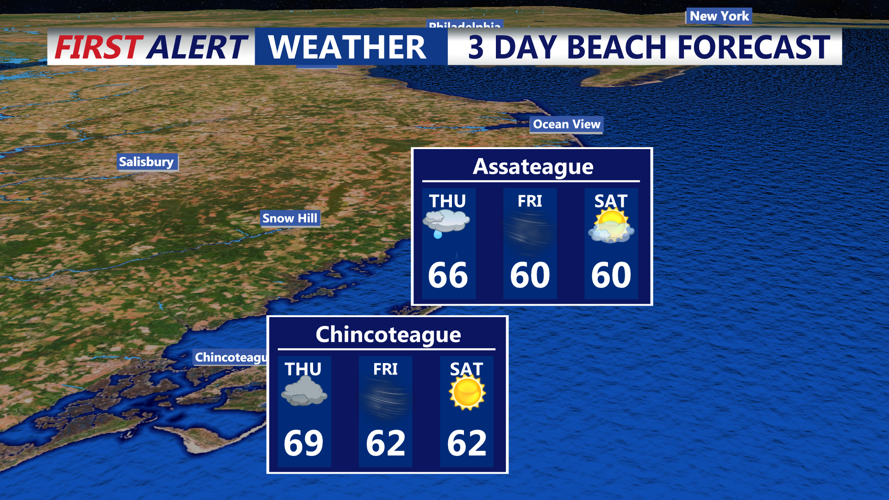


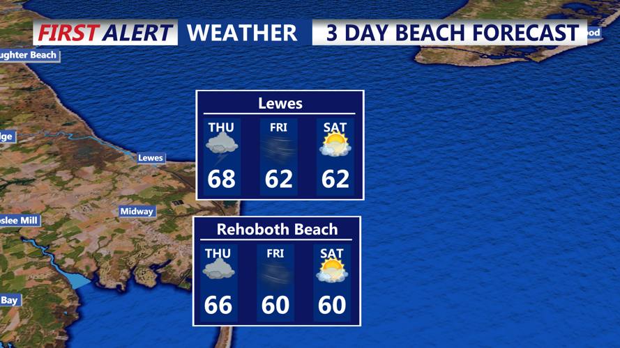


DELMARVA - Residents of Sussex County, Delaware should prepare for a period of steady rain and breezy conditions beginning late Wednesday evening and continuing into Thursday evening.
A weak coastal low will merge with a stronger system tracking northeast from the Tennessee Valley, resulting in rain overspreading the region after midnight Wednesday and persisting through the morning commute Thursday. Forecasts call for rainfall totals of 1 to 3 inches, mainly across a 6- to 12-hour window.
Although widespread flooding is unlikely given the relatively dry antecedent soil, isolated heavier bursts — approaching 1 inch per hour — may occur, especially in urban corridors. The risk of excessive rainfall remains marginal.
Wind conditions will also warrant attention. A strong low-level jet is expected to drive gusts up to 40–50 mph along the coast, with inland gusts in the 25–35 mph range, and possibly reaching 40 mph in some spots. An isolated severe threat — including brief tornadoes or severe-gust wind events — cannot be ruled out, especially south of I-695 and near the Delaware beaches.
Sky conditions will largely be mostly cloudy through Wednesday evening, transitioning to widespread rain overnight, tapering off from southwest to northeast as Thursday progresses.
Thursday’s high temperature is expected to reach the upper 60s to around 70 °F as the warm sector envelops the area, followed by clearing later in the day.