


DELMARVA - We're seeing a much needed break from the excessive heat and humidity today, as a slightly cooler and drier airmass has settled over Delmarva. The humidity returns this weekend with showers and storms, with hot conditions on Sunday.
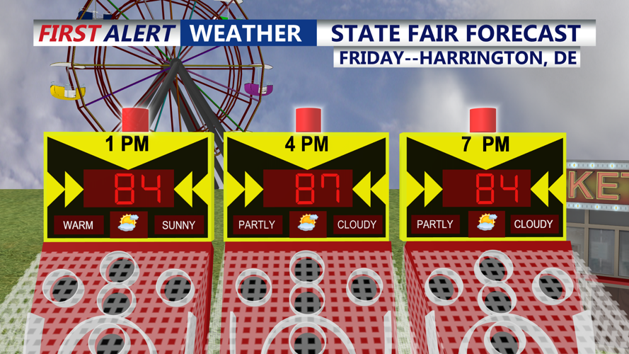
A great day for outdoor activities to end the week, with a slightly cooler and drier flow from Canadian high pressure over the Great Lakes. We'll see seasonably warm conditions this afternoon with lower humidity levels. Looking great if you're headed to the State Fair in Harrington, Delaware. Highs in the mid to upper 80s this afternoon.

Pleasant afternoon, not as oppressive, can't rule out a pop-up shower, especially later in the evening.
This evening, watch for a few showers and storms, otherwise a few showers still possible overnight with lows in the 70s.
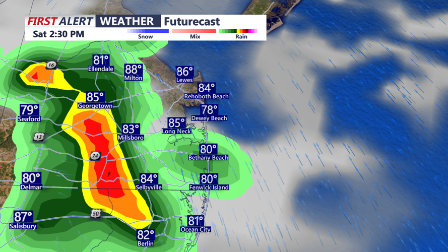
The weekend starts a little more unsettled with mostly cloudy skies with a chance for showers and thunderstorms, especially into the afternoon hours. Watch for heavy rain and perhaps damaging winds with some of the storms. Highs in the mid 80s, then cooler later in the afternoon with the showers and storms.

Scattered showers and storms are possible Saturday afternoon, some storms could produce some localized flash flooding.
Saturday night will dry out with partly cloudy skies and lows in the mid 70s.
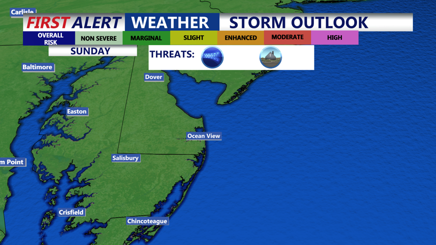
For Sunday, as a cold front approaches, expect another round of showers and possible thunderstorms. Some storms could contain damaging winds and heavy rain.

As we go into Sunday the Storm Prediction Center has the entire peninsula in a "Marginal" risk (1 of 5), damaging winds, hail, flash flooding possible.
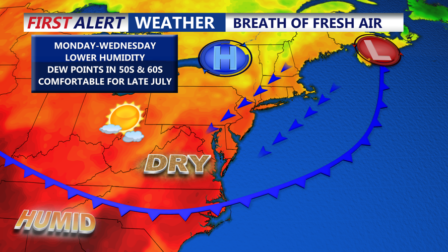
A pleasant airmass will build into the region early next week promising much lower humidity, mostly sunny skies, and temperatures a bit below average.

Welcoming comfortable air early next week as a backdoor cold front brings relief from the stifling humidity.


