


DELMARVA - Calmer weather is expected early Wednesday after rounds of showers and thunderstorms moved through the region Tuesday.
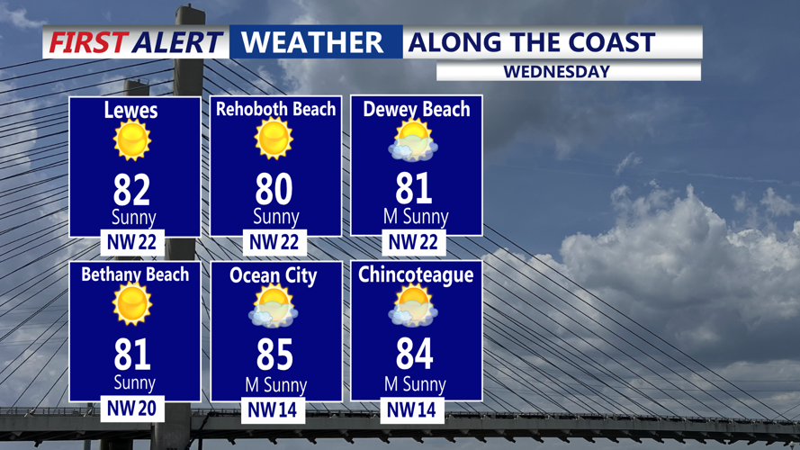
Wednesday should bring partly to mostly sunny skies and lower humidity as low pressure pulls away from Delmarva. Temperatures are expected to climb into the mid-80s during the afternoon.
Winds should come from the northwest at 10 to 15 mph, helping bring in a drier and more comfortable air mass. No widespread rain is expected during the day Wednesday.
Wednesday night should remain mostly clear and mild, with temperatures falling into the lower to mid-60s. Winds are expected to shift to the southwest at around 5 to 10 mph.
By Thursday morning, Sussex County should start the day mostly sunny and warmer. Temperatures are expected to rise quickly through the morning, with highs later Thursday likely reaching the upper 80s.
Another cold front approaching late in the week could bring the next chance for showers and thunderstorms, mainly later Thursday into Friday.