



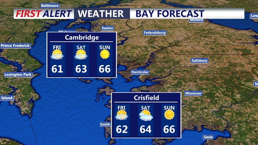


DELMARVA - Coastal flooding and rough surf will gradually diminish Friday as Subtropical Storm Josephine moves farther into the Atlantic, while a surge of chilly air raises the possibility of frost across early Saturday morning.
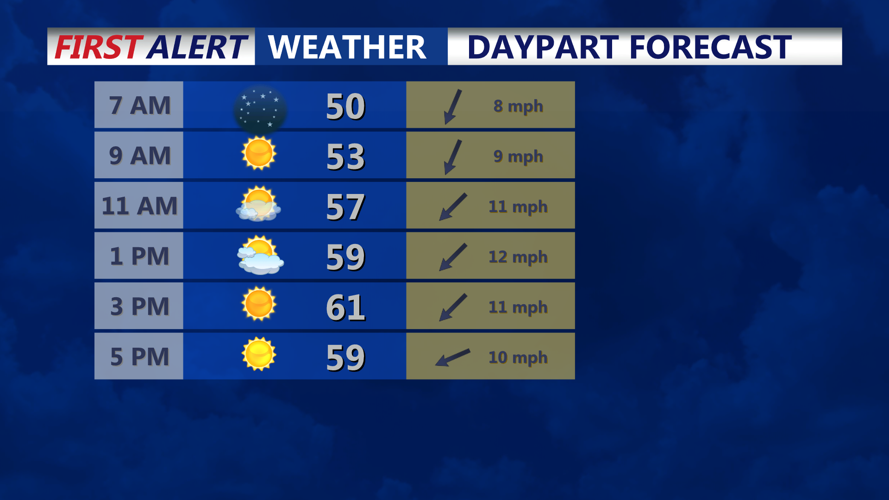
Friday morning will begin with mainly clear skies, dry conditions and cool temperatures as high pressure continues building into the region. Northeast winds around 10 to 15 mph will maintain a chilly feel, particularly along the Delaware beaches.
Although Josephine remains well offshore, elevated water levels will continue, especially communities surrounding Rehoboth Bay, Indian River Bay and Little Assawoman Bay.
A Coastal Flood Advisory remains in effect until midnight Friday night. Minor tidal flooding could continue around high tide, with water covering some low-lying roads and properties near the back bays. Residents in flood-prone neighborhoods should continue monitoring water levels even as conditions gradually improve.
Meanwhile, rough surf and elevated seas will remain concerns along the Atlantic coastline from Cape Henlopen through Ocean City. Offshore waves could remain above 5 feet through Friday night, with additional beach erosion possible around high tide.
Small Craft Advisories remain in effect for Delaware's Atlantic coastal waters into Friday night and early Saturday morning. Boaters should exercise caution as hazardous wave conditions gradually subside.
Friday afternoon will feature generally sunny skies and dry weather as high pressure strengthens across the Mid-Atlantic. No precipitation is expected, and winds should gradually ease as the storm moves farther away.
Attention will then turn to falling temperatures Friday night into early Saturday morning.
Under mainly clear skies and diminishing winds, temperatures are expected to drop into the 30s, including Georgetown, Millsboro, Seaford, Laurel, and Salisbury. The combination of light winds, dry air and clear skies could allow patchy frost to develop in colder inland locations before sunrise Saturday.
Communities closer to the Atlantic Ocean and Delaware Bay, including Lewes, Rehoboth Beach, Bethany Beach, Fenwick Island, and Ocean City, should experience somewhat milder overnight temperatures, reducing the likelihood of frost immediately along the coast.
Although no Freeze Watch was indicated for Sussex County in the supplied forecast discussion, residents with sensitive vegetation should consider taking precautions against possible frost, especially in rural and sheltered inland areas.
By early Saturday morning, quieter weather will dominate as high pressure settles over the region. Coastal water levels and wave heights should continue their gradual decline, setting the stage for a dry but chilly start to the weekend.
