


DELMARVA - Tuesday begins on a relatively quiet note, but the day will mark another step toward a dangerous stretch of heat building across Delmarva.
Tuesday morning will start mild, with temperatures rising quickly after sunrise. Afternoon highs are expected to reach the upper 80s to near 90 degrees inland, with slightly cooler conditions along the beaches. Humidity will not be at its worst yet, but a warmer air mass will continue to settle into the region.
Most of Tuesday will stay partly sunny and dry, though a stray shower or thunderstorm cannot be ruled out late in the afternoon or Tuesday evening. The best chance for stronger storms should remain north of Sussex County, but any storm that does develop could bring gusty winds.
By Tuesday night into early Wednesday morning, skies will be partly cloudy and conditions will turn warmer and more humid. Overnight lows will settle mainly in the upper 60s to low 70s, signaling the arrival of a more uncomfortable air mass.
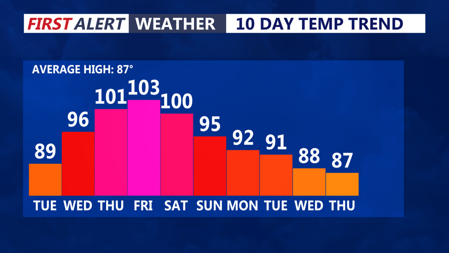
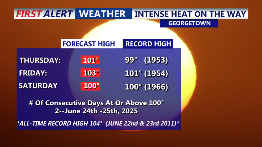
The bigger weather story will begin Wednesday and continue through Saturday. An Extreme Heat Watch has been expanded to include Delmarva as dangerous heat and humidity build across the Mid-Atlantic. Sussex County could see heat index values climb near or above 100 degrees Wednesday, with even more intense heat expected Thursday and Friday.
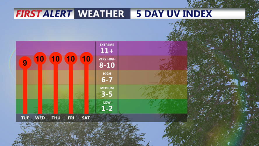
The UV index is also expected to reach 10, one step below the “extreme” category. That means sunburn can happen quickly during the late morning and afternoon, especially for those spending time at the beaches, pools, ballfields or outdoor events.
Thursday and Friday could bring the most dangerous conditions, with inland highs possibly approaching or exceeding 100 degrees and heat index values reaching the 105- to 110-degree range. All-time record highs may be challenged as strong high pressure locks in over the region.
Residents and visitors should use Tuesday to prepare for the upcoming heat by limiting strenuous outdoor activity later this week, checking on vulnerable neighbors and making sure pets have shade and water. Storm chances may return Friday into the holiday weekend, but the heat will remain the main concern.
