





DELMARVA -- A muggy and unsettled weather pattern begins today across Delmarva as a warm front lifts north and deep tropical moisture returns to the region.
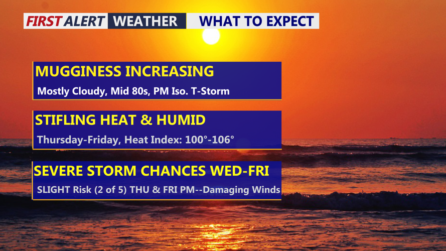
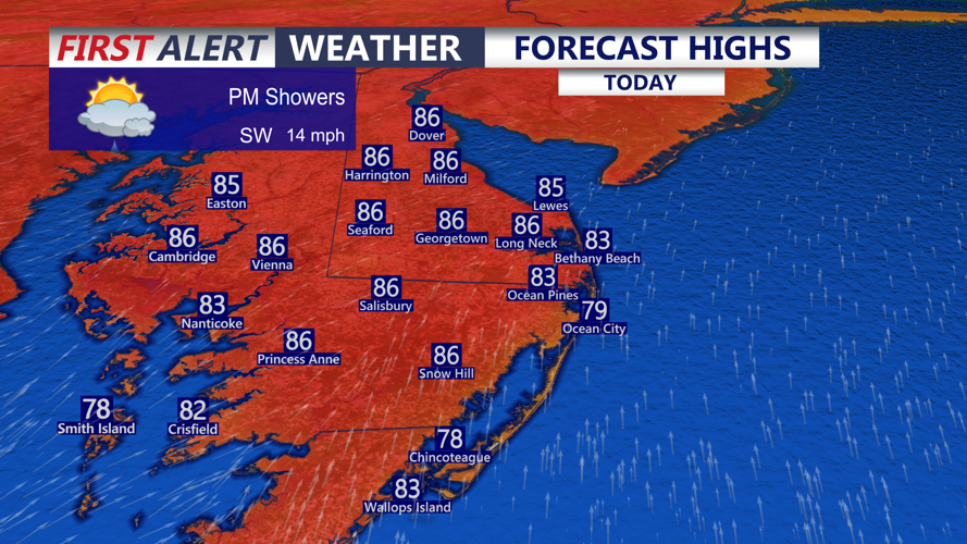
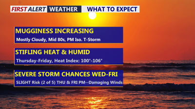
Clouds will dominate much of the day, helping to keep temperatures mainly in the mid 80s. However, humidity will climb quickly, with dew points rising near 70 degrees by this afternoon. That will make it feel noticeably sticky and uncomfortable despite the cloud cover.

Mostly cloudy skies, spotty showers, isolated gusty t-storm early this evening.
Scattered showers and thunderstorms are expected to develop by mid to late afternoon and continue into the evening, mainly between about 4 p.m. and 10 p.m. The storms are not expected to be highly organized, but a few stronger storms cannot be ruled out. The main concern will be isolated damaging wind gusts, especially if storms can briefly form into a broken line.
Heavy rain will also be possible. With very high moisture levels in place, any stronger storm could produce brief, blinding downpours. Localized urban or poor drainage flooding may occur in spots that see heavier rainfall. The Storm Prediction Center has placed all of Delmarva under a Marginal Risk, level 1 out of 5, for severe weather today.
Tonight will stay warm and muggy, with lows falling only into the mid 60s to low 70s. Areas that receive rain today could see fog or low clouds develop late tonight into early Thursday morning.
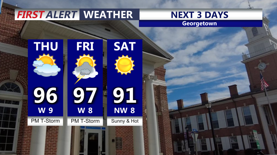
The heat and humidity will become a bigger concern Thursday and Friday. High pressure near the Southeast will help build hotter conditions across Delmarva, with afternoon temperatures climbing into the low to mid 90s both days. Friday may end up slightly hotter than Thursday.

Hot and humid Thursday and Friday, feeling like over 100, late gusty t-storms possible both days.
When combined with the humidity, heat index values are expected to reach 95 to 104 degrees across much of Delmarva. Residents should plan for potentially dangerous heat, especially during the afternoon and early evening hours.
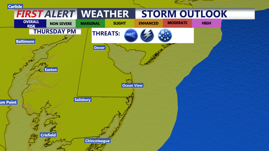
Thunderstorm chances will continue Thursday and Friday. On Thursday, storms may be fueled by the heat, humidity and a disturbance moving in from the west. Damaging winds will be the main threat, though large hail cannot be ruled out. The Storm Prediction Center has placed Delmarva under a Slight Risk, level 2 out of 5, for severe storms Thursday.

Isolated gusty storm this evening, SLIGHT risk (2 of 5) for severe storms Thursday late afternoon-evening, damaging winds and hail is the primary threat.
Another round of scattered showers and storms is possible Friday as a cold front approaches from the west. With strong instability and somewhat better winds aloft, severe thunderstorms may again develop. Delmarva is also included in a Slight Risk for severe weather Friday.
The weekend is now trending drier behind the cold front, with much of Saturday and Sunday expected to be mainly dry. Not has humid but highs in the low 90s. Another front may approach late in the weekend or early next week, bringing renewed chances for showers and thunderstorms.
