




DELMARVA - Out the door this morning, expect mainly clear skies and pleasant temperatures in the 60s.
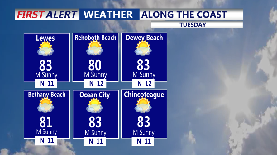
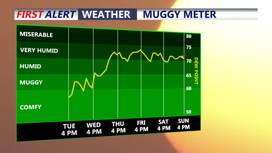
High pressure will slowly build into the region Tuesday and Wednesday. Highs will be in the mid 80s with comfortable humidity levels. Most of Delmarva should remain dry, although an isolated afternoon shower cannot be completely ruled out Tuesday. The better chance for scattered showers and thunderstorms associated with an upper-level disturbance is expected to remain north of the peninsula.
Wednesday is expected to remain largely quiet and comfortable as high pressure settles closer to the region.
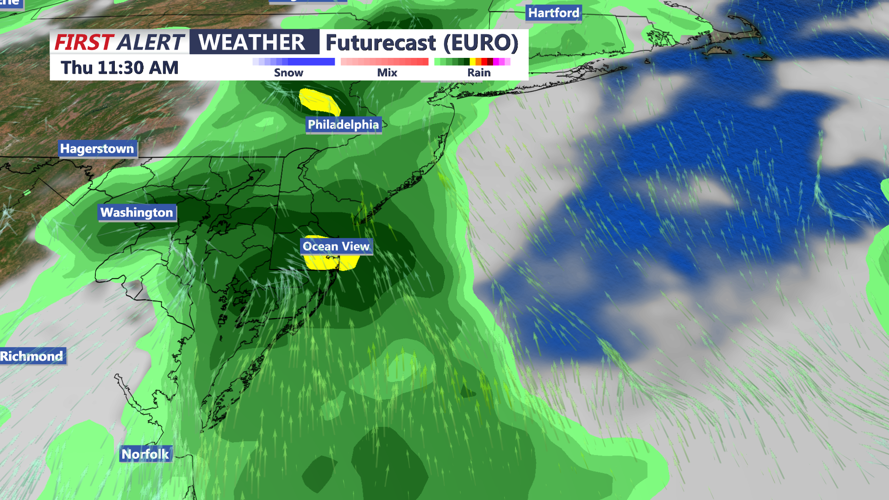
Changes arrive Thursday as high pressure moves offshore and a warm front crosses the area. Southerly winds will bring warmer and more humid air back to Delmarva, with dew points climbing into the lower 70s. Scattered showers and thunderstorms could develop Thursday as the warm front moves through.
Another round of unsettled weather is possible Friday into Saturday as a cold front approaches Delmarva. Showers and thunderstorms will become possible again, although the exact timing of the front remains uncertain.
That timing will play an important role in determining whether any storms could become strong or produce locally heavy rainfall. Those details should become clearer as the end of the week approaches.
Long range models are indicating building heat to our west for the start to September. It appears we'll see 90s returning, with humid conditions as well.
