


DELMARVA - Sussex County will see a shift in the weather pattern starting early Saturday and continuing through early Monday, with off-and-on rain, rising temperatures, and eventually a break from the heat as a cold front moves through.
Saturday: Spotty Showers, Marginal Flood Risk
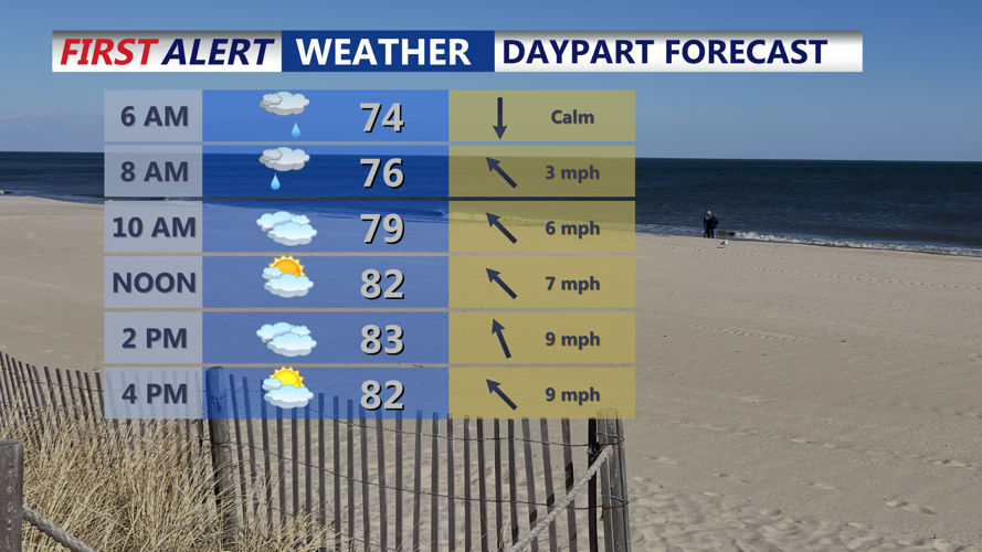
By early Saturday, a moist and increasingly unstable atmosphere will support the development of scattered showers and isolated thunderstorms across the region. While severe storms are not expected, the National Weather Service highlights a Marginal Risk for excessive rainfall, meaning localized heavy downpours may lead to minor flooding, particularly in low-lying or poorly drained areas.
Skies will remain mostly cloudy through the day, limiting surface heating. Temperatures will reach the low to mid 80s, but dewpoints climbing into the upper 60s and low 70s will make it feel more humid. Winds will remain light out of the southeast at around 10 mph or less.
Saturday Night: Continued Muggy with Passing Showers
Showers may linger into Saturday night, though widespread rain is not expected. A few rumbles of thunder are possible, especially earlier in the night. The air will remain humid, with overnight lows in the upper 60s to low 70s under mostly cloudy skies.
Sunday: Hot and Humid with a Late-Day Cold Front
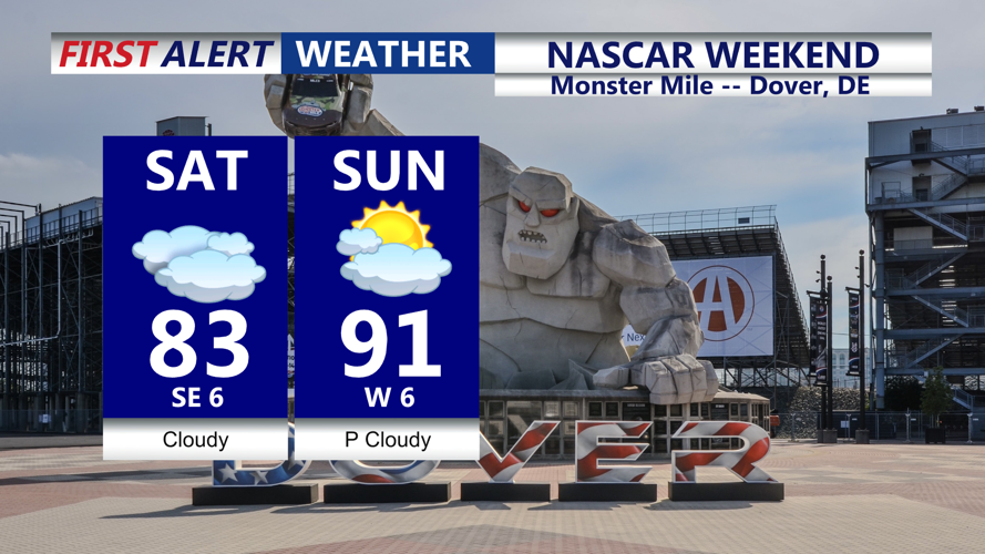
A brief lull in rain is anticipated Sunday morning into early afternoon, allowing partial clearing and a burst of sunshine. That clearing, paired with high dewpoints, will send heat index values into the mid to upper 90s across Sussex County. Actual air temperatures could reach the upper 80s to near 90 degrees, making it the warmest day of the weekend.
By late Sunday afternoon into Sunday evening, a cold front will approach from the northwest, bringing a renewed chance for isolated to scattered thunderstorms. Some of these could become strong, with gusty winds and heavy rain. Storms are expected to move from northwest to southeast and taper off by late Sunday night.
Early Monday: Cooler and Drier Air Arrives
Behind the cold front, much more comfortable air filters into the region by early Monday. Morning lows will dip into the mid to upper 60s, with lower humidity and partly sunny skies expected by daybreak. The start of the new week will feel noticeably cooler and more pleasant than the weekend.