


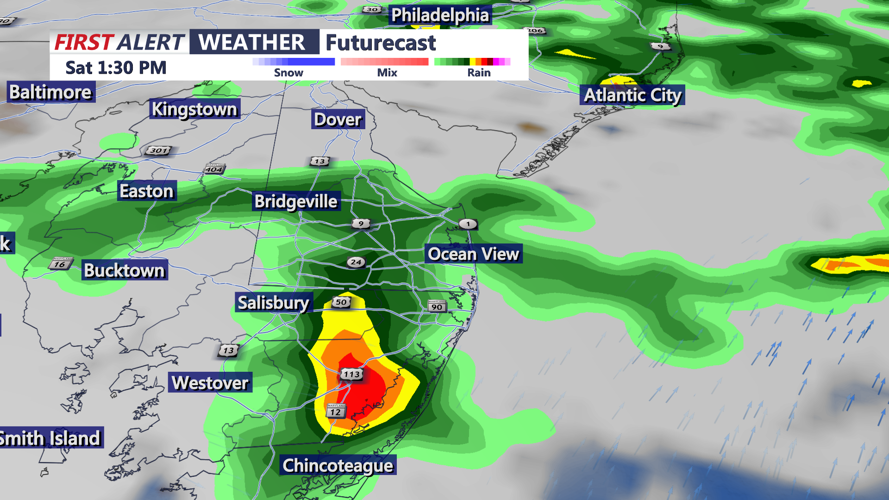
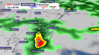


DELMARVA - A cold front is drifting southeast across Delmarva as low pressure over the Ohio Valley slowly moves east, allowing showers to continue this morning. Temperatures are mild, in the low 70s, and it remains mild.
It will remain muggy and unsettled today, with on-and-off showers and storms possible throughout the day. Highs will be cooler, topping out in the lower 80s, with the humidity remaining noticeable.
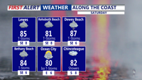
Conditions improve by Sunday as the front sags farther south into the Mid-Atlantic and high pressure builds in from the north. Sunday will be the drier day of the weekend, with partly cloudy skies and highs in the low 80s.
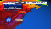
Looking ahead, heat is expected to build back into Delmarva by the middle and end of next week. Highs will be in the mid 90s beginning as early as Wednesday, with temperatures near 100 both Thursday and Friday. Heat index values will be in the lower 100s.
As of now, the Fourth of July holiday weekend is looking slightly cooler, but still hot, with highs in the low to mid 90s, and high humidity to go with it. A few isolated storms are possible, but a washout isn't anticipated at this point.