


SUSSEX COUNTY, Del.-Ten years ago Delmarva was in the midst of one of its snowiest stretches in history.
Between January 28th and February 11th 2010, the peninsula bore the brunt of three separate winter storms--now referred to as "Snowmageddon."
"Really the first event was one that came up out of the Gulf and dropped a significant amount of snow, but not a huge amount of snow across the state," explains Delaware's State Climatologist Daniel Leathers. "But then of course the big one that everyone remembers as Snowmageddon was the February 5th and 6th storm."
The third storm that impacted Delmarva occurred on February 9th and 10th.
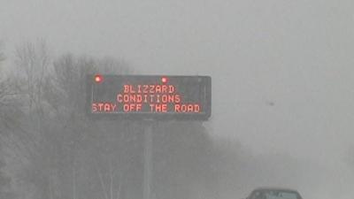
During that stretch of wild weather Delmarva had two Blizzard Warnings and a Winter Storm Warning issued. There's a key difference between the two.
A Winter Storm Warning is issued when significant snow or ice is expected or is impacting the region. A Blizzard Warning on the other hand has a strict definition where there must be winds or wind gusts of 35 mph or higher with visibility at least a quarter mile or less as a result of falling or blowing snow.
"The issue with all those storms was they produced, many of them produced copious amounts of snow along with wind," recalls Joe Miketta, the Warning Coordination Meteorologist at National Weather Service in Mt. Holly, New Jersey. "[It produced] a strong onshore flow which produced tidal flooding in some cases."
Snowmageddon brought record snow totals to Delmarva. Some areas saw over 40 inches of snow and wind gusts at times over 60 mph.
Greenwood set Delaware's new two day state record snowfall of 29 inches between February 5th and 6th.
This combination of snow and wind created havoc here on Delmarva due to people being trapped, schools and businesses being closed, and roofs collapsing.
This is part one of our special look back at Snowmageddon. Part two will dive deeper into the phobias and personal impacts of the winter storm felt here at home.