
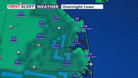
.Generally tranquil weather is expected to prevail through at least the beginning of next week. High pressure continues to shift offshore through the rest of today and tonight as low pressure moves through eastern Canada. A dry cold front associated with this low will move through tomorrow morning. High pressure will then return through early next week with continuing mild and dry conditions expected. After a relatively warm day today, it will be mild tonight with lows in the upper 40s to low 50s. Friday will turn breezy in the wake of the morning cold frontal passage. Northwest winds 10-15 mph with gusts up to 25 mph can be expected. Conditions will turn cooler again for the weekend. Lows Friday night through Sunday night will be mainly in the mid 30s to mid 40s, but frost currently appears unlikely where the growing season continues. Highs will be coolest on Halloween, in the upper 50s to low 60s, under partly cloudy skies. Partly to mostly cloudy skies Sunday, but a bit milder with highs in the low to mid 60s. The system which had potential to affect the region early next week now appears to weaken and miss our region for the most part. This will keep our region dry, but still increase cloud cover. We cannot totally rule out a few showers midweek, but the next period to keep an eye on for widespread rainfall looks to be toward the end of next week (Thursday into Friday), when guidance suggests a more prolific system may impact the region. && .AVIATION /18Z THURSDAY THROUGH TUESDAY/... The following discussion is for KPHL, KPNE, KTTN, KABE, KRDG, KILG, KMIV, KACY and surrounding areas. This afternoon...Low strato cu was still bringing some MVFR cigs at RDG and ABE early this afternoon but this should scatter out by mid to late afternoon. Otherwise VFR. Southwest winds around 5-10 knots. High confidence. Tonight...VFR. Southwest winds 5-8 knots. High confidence. Friday...VFR. Winds shifting to northwest through mid morning with the passage of a cold front and increasing to around 10 knots with gusts to around 20 knots. Outlook... Saturday through Tuesday...VFR. No significant weather. && .MARINE... Tranquil conditions expected on the waters with no hazards through tonight. For Friday into Friday night, Northwest winds increasing to 15-20 kts in the wake of a cold front, with gusts up to 25 kts (30 kts offshore). At this time, the greatest probability of 25 kt gusts is still across the northern New Jersey coast, thus a Small Craft Advisory is in effect from 2 PM Friday through 2 AM Saturday for this area. This may need to be expanded farther south in a future update, but the stronger gusts may stay mostly confined to the offshore waters. Outlook... Saturday through Tuesday...No marine hazards expected. Fair weather.

Sussex County will see mild temperatures and gusty winds Friday before cooler, dry weather arrives for Halloween.