


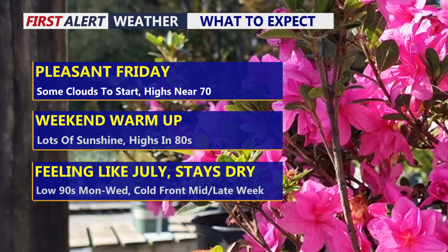
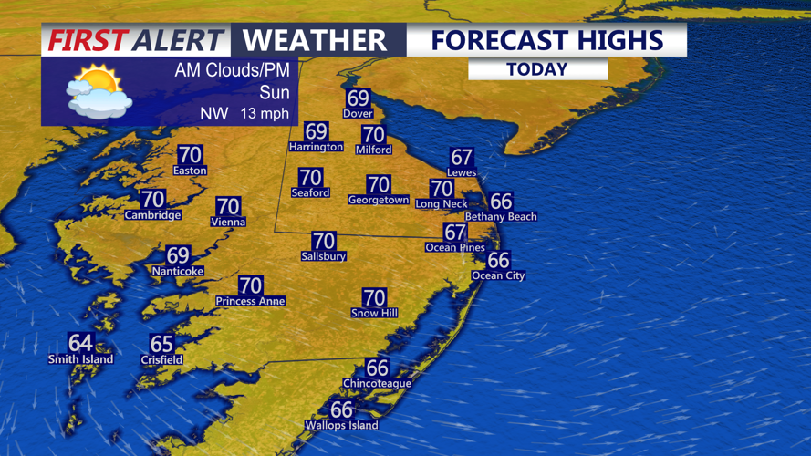


DELMARVA -- A beautiful Friday with mostly sunny skies and temperatures still running a little below average for mid-May. Highs will reach the upper 60s to low 70s, with a northwest breeze continuing at 10 to 20 mph. An upper-level low pressure system lingering over the region will move away tonight, allowing surface high pressure to build in later.
Tonight will be calm and clear, with starry skies and temperatures falling into the upper 40s and low 50s.
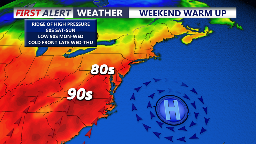
After Friday’s seasonable conditions, a much warmer pattern will take over across Delmarva this weekend and continue into the middle of next week. An upper-level ridge will build into the Eastern United States, while high pressure settles over the western Atlantic just off the Mid-Atlantic coast. This setup will bring a warm south to southwesterly flow, gradually pushing temperatures higher each day.
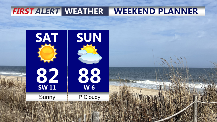
Saturday will be warmer, with highs mainly in the upper 70s to low 80s. By Sunday, inland areas of Delmarva will climb into the mid to upper 80s to near 90, while the immediate coast stays about 5 to 10 degrees cooler thanks to the influence of cooler ocean waters.
The heat will continue to build Monday through Wednesday. Many inland areas of Delmarva could reach the upper 80s to low 90s Monday, with some spots potentially climbing into the mid 90s Tuesday or Wednesday. Temperatures may approach record high territory during this stretch, though humidity levels are not expected to become especially oppressive early in the week.
The next five days look mostly dry overall. A few isolated showers or thunderstorms cannot be ruled out Sunday, especially near local boundaries such as the sea breeze, but rain chances remain low.
A cold front is expected to approach late Wednesday, bringing a better chance for showers and thunderstorms into Thursday. That front should also bring an end to the stretch of above-normal temperatures, with conditions moderating closer to normal by late next week.