


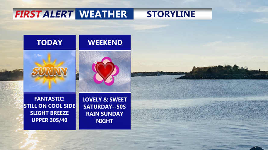


DELMARVA -- We are closing out the workweek with the kind of sky you wish you could order on demand: pure sunshine from start to finish today. It’s a beautiful day, but not quite the warmth we’re craving yet—temperatures are running around 10 degrees below average. Add in a northwest breeze with gusts near 20 mph, and you’ll definitely feel that chill, especially if you’re out near open areas or the water.
Tonight stays crystal clear and turns sharply colder, with lows dropping into the low to mid 20s—a good night to protect tender plants and bring pets inside if they’re not already.
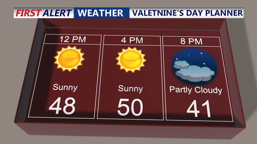
The weekend begins on a high note. Valentine’s Day, delivers a mostly sunny and pleasantly crisp setup, with afternoon highs reaching the upper 40s to low 50s across Delmarva. It’s a great day for outdoor dinner plans, winter walks, or any last-minute Valentine’s errands without weather headaches.

Lovely and sweet, mostly sunny highs in the upper 40s to low 50s on Delmarva.
Saturday night lows dip into the low 30s, and clouds start increasing late as we head toward Sunday.
Sunday, turns mostly cloudy, and highs settle back into the mid to upper 40s—still manageable for mid-February, just not as bright as Saturday.

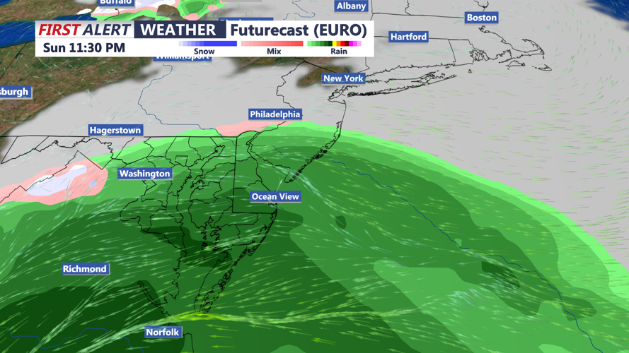
A period of rain is expected Sunday evening through early Monday morning.
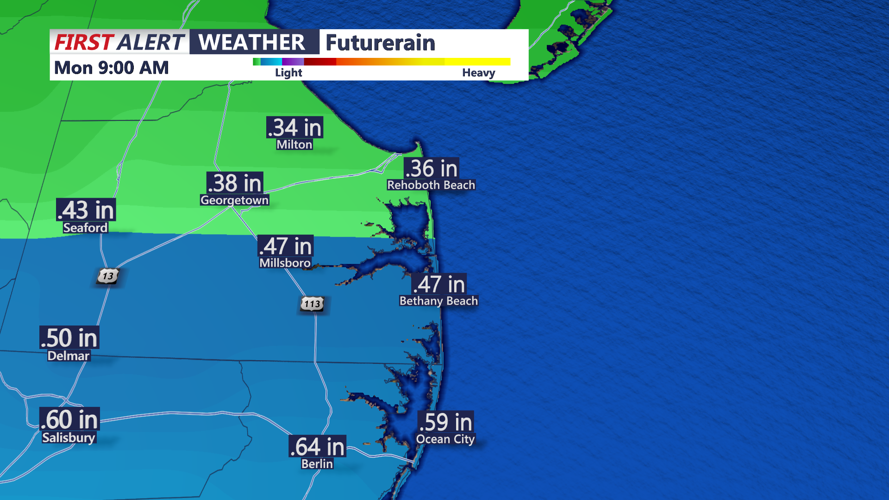
Looking ahead, forecast confidence is increasing that the next system takes a more southerly track and doesn’t fully link up with the northern-stream energy while it’s near our region. This favors a warmer, faster system, so precipitation will be rain. Importantly, the air mass ahead of this system is milder than what we’ve had with recent events, which also works against meaningful snow accumulation. At this point, the expectation is little to no snow accumulation, while rainfall totals look to average around a half-inch, with locally higher amounts possible, especially the farther south you go on Delmarva.

An average of half an inch of rain is expected, higher amounts are possible the further south you go.
That said, not every model is fully on board—there are still a few solutions that suggest a stronger and farther north track. We’ll keep an eye on that trend, but overall, guidance is increasingly clustering toward the coastal-rain, low-snow-impact scenario.
Once that system moves through, the overall pattern turns friendlier: temperatures look to hold at or above average, with highs in the low to mid 50s, and there’s even potential for Delmarva to make a run at 60 degrees by Thursday.
