


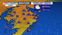


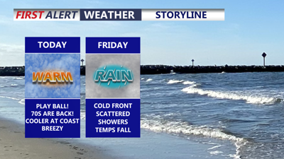
DELMARVA - Today feels much more like spring across Delmarva as temperatures surge into the mid to upper 70s for much of the peninsula, while the beaches stay a little cooler in the upper 60s. Partly cloudy skies will be in place through the day, but it will turn breezy at times with southwest wind gusts reaching up to 35 mph.

Mid to upper 70s inland, cooler at the beaches under partly cloudy skies, winds out of the southwest gusting to 35 mph.
Tonight stays unusually mild for late March, with temperatures holding in the mid to upper 60s just after midnight before gradually slipping toward morning. Low pressure passing north of the region will drag a cold front into Delmarva by Friday, setting the stage for a wetter and cooler end to the workweek.

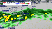
Scattered showers develop Friday morning and persist into the evening, chilly raw conditions develop.
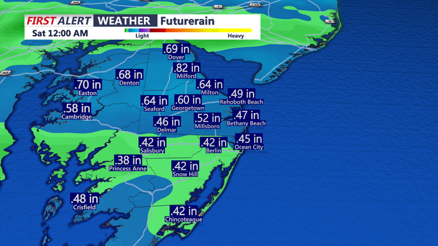
Showers are expected to develop by late Friday morning, with scattered rain continuing through the afternoon and evening as the front slows and becomes nearly stationary over the peninsula for much of the day. Rainfall totals will generally range from 0.30 to 0.75 inches, although a few locally higher amounts are possible.

Expected rainfall between 0.30" to 0.75" with some locally higher amounts into Friday evening.
Temperatures on Friday will move in the opposite direction from what many expect, falling through the day as colder air pours in behind the front. Morning readings in the low to mid 60s will give way to afternoon temperatures dropping into the upper 40s to low 50s for many communities, with most spots spending much of the day in the mid to upper 50s. Raw day to say the least.