


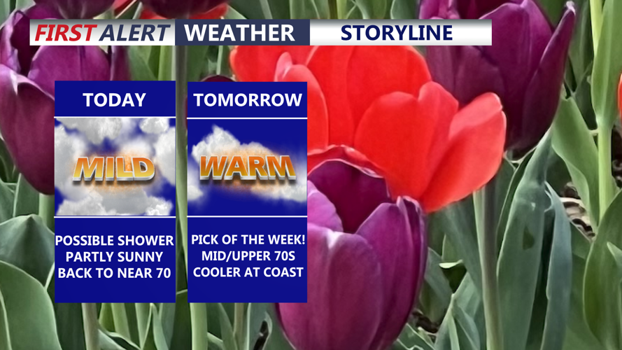


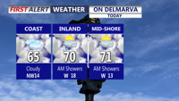


DELMARVA -- Starting off on a mild note today as a weak area of low pressure moves through the region, bringing the chance for a few light rain showers. While skies turn partly sunny later in the day. Afternoon highs are expected to climb into the upper 60s to near 70.

Isolated shower possible, partly sunny and mild with highs around 70.
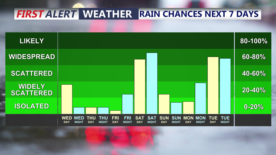
As we move into this evening and tonight, a weak cold front will slide south across the area. While it does not look especially strong, it could still trigger an isolated shower before drier air gradually works in overnight. Some patchy fog may also develop late tonight as winds become light and leftover moisture gets trapped near the ground.

Chance of a shower today, better chance for rain late Saturday afternoon-night.
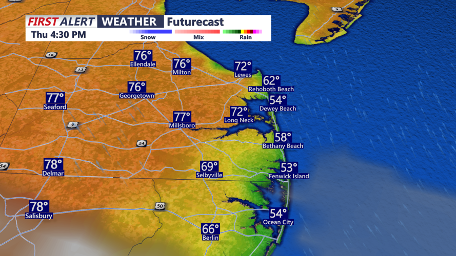
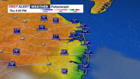
Thursday looks like the warmest day in the stretch for Delmarva. High pressure will build in, helping to bring dry conditions and above-normal temperatures. Highs should reach the low to mid 70s, with some inland spots away from the coast and bay possibly running a little warmer.

Thursday will be the pick of the week, mostly sunny and warm highs in the mid to upper 70s, cooler at the coast.
That warmer pattern does not last long. A backdoor cold front is expected to slip through on Friday, bringing cooler air back into the region. A few showers may develop, but much of the day should remain mostly dry. Even so, temperatures may end up cooler than currently forecast if that front moves through faster than expected. 50s/60s along the coast, low 70s on the Mid-shore.
