


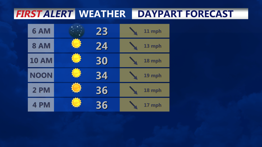


DELMARVA - High pressure will continue building into Sussex County and the Ocean City area Friday night, bringing a shift toward calmer conditions after a breezy and cold day. Strong northwest winds will persist into the afternoon, with gusts of 30 to 35 mph before gradually diminishing in the evening. Temperatures will remain below normal, with daytime highs in the low to mid-30s and wind chills staying in the 20s.
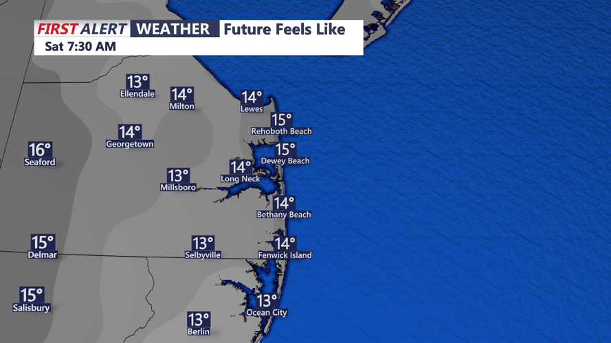
By Friday night, winds will ease, and skies will remain mostly clear. Temperatures will drop into the teens and low 20s, though lighter winds will keep wind chills from falling as drastically as the previous night.
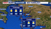
Saturday will bring a quiet weather pattern, with high pressure firmly in control. Temperatures will trend a few degrees warmer, reaching the upper 30s to low 40s under mostly sunny skies. Winds will be light, making for a much more comfortable day despite the continued chill.
By Sunday, temperatures will climb closer to seasonal norms, with highs in the low 40s north to upper 40s south. Skies will remain mostly clear, though occasional cloud cover may pass through as weak upper-level disturbances move by.
Overnight lows will also moderate slightly, with temperatures in the 20s across the region. Looking into next week, the warming trend continues, with highs reaching the upper 40s to mid-50s. While a few weak systems may bring scattered rain showers, no significant weather impacts are expected.