


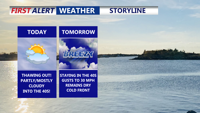
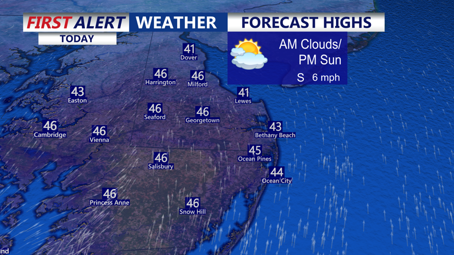


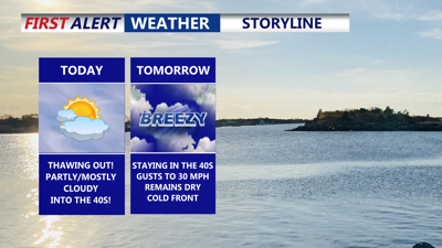
DELMARVA -- Thawing out on the peninsula! After recent cold, Delmarva gets a welcome temperature rebound today as a warm front lifts through the region tonight. Expect partly to mostly cloudy skies with afternoon highs climbing into the mid to upper 40s. Winds will favor the south at 5 to 15 mph, adding to the mild feel.

Partly to mostly cloudy skies highs range from 44 to 50 on Delmarva.
Heading into tonight, clouds hang tough and the breeze picks up a bit, with gusts near 20 mph at times this evening and overnight. You can’t rule out a spot shower or sprinkle, but most of us stay dry. Temperatures should also cooperate—many locations remain above freezing, bottoming out in the mid to upper 30s under mostly cloudy skies.

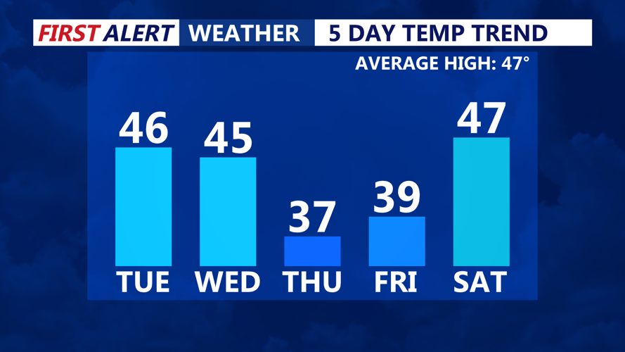
Seasonable temperatures over the next few days, cooler air by late week.
Wednesday stays seasonably mild with more 40s and a mix of clouds and sun. The bigger story will be wind: as a cold front approaches, conditions turn breezy, with gusts up to 30 mph possible. This front looks moisture-starved, so rainfall chances remain limited.
Behind the front, we trend cooler for Thursday and Friday—not true arctic air, but definitely a step down. Thursday looks partly cloudy and breezy with highs in the mid to upper 30s, while Friday shapes up as a beautiful mostly sunny day, topping out in the upper 30s to low 40s.
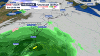
The weekend starts on a lovely note Valentine’s Day brings mostly sunny skies and highs in the upper 40s to near 50, with clouds increasing late. After that, we’re keeping a close eye on a storm system that could affect Delmarva late Sunday into early Presidents’ Day.

A storm system late Sunday-Monday could bring rain to the area, still uncertainty to the overall track and intensity of this system.
Guidance continues to suggest at least some precipitation, but there’s still uncertainty in the track, timing, and intensity—and the air mass ahead of it doesn’t look especially cold, which matters for precipitation type.
Beyond that storm threat, early next week trends slightly above average, with highs pushing back into the low 50s.
