


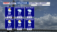
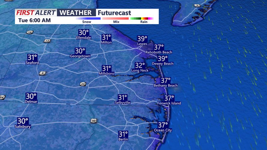

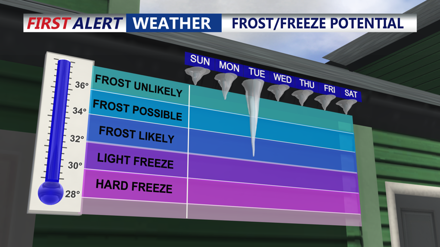


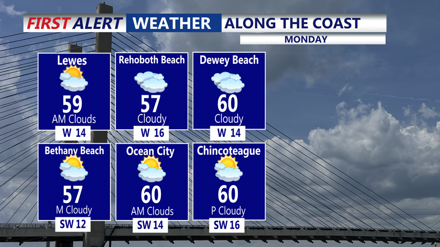
DELMARVA - Mostly clear to partly cloudy overnight with temperatures dipping into the upper 30s and low 40s by Monday morning. A cold start to the week, but with cloud cover and a light breeze, frost formation will be limited this morning, despite temperatures falling into the 30s and 40s. Monday itself will feel dramatically cooler with highs only in the mid 50s, or roughly 10 to 15 degrees below normal. A few showers are possible. Breezy northwest winds will continue, with gusts up to 30 mph under partly cloudy skies.
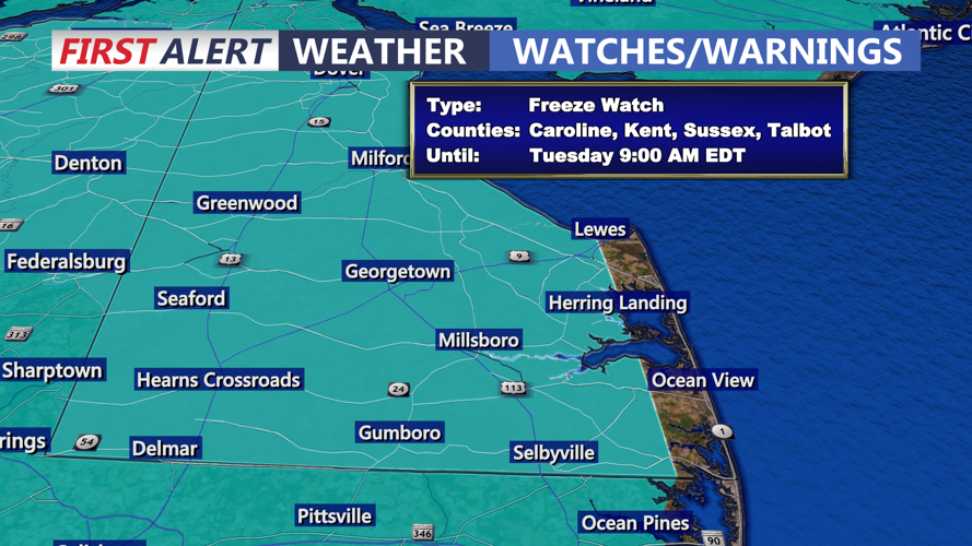
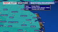
Week starts breezy and chilly, Freeze Watch Tuesday morning
-
btrihy
Meteorologist
Meteorologist Bob Trihy joined CoastTV in 2023. He grew up in Great River on Long Island, N.Y. Bob caught the weather bug when he was around eight years old and tracked storms up and down the east coast. He witnessed some big ones, like the blizzard of 1978, as well as tropical systems.
