


DELMARVA- Several advisories are on the radar for the upcoming forecast, including wind and floods.
A Wind Advisory is in effect from early Friday morning to 7 a.m. Friday. The winds will be coming from the South at 25 to 35 mph with gusts up to 50 mph. These are expected to be in portions of southern Delaware. Be aware that the gusty winds could blow around unsecured objects. Tree limbs could also be blow down and could cause power outages. The strongest of the winds will be near the immediate coast.

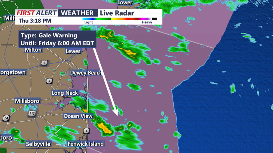
The Gale Warning remains in effect from 6 p.m. Thursday evening to 6 a.m. Friday. For the Small Craft Advisory, south winds will be 15 to 20 knots with gusts up to 25 knots.
The Gale Warning remains in effect from 6 p.m. Thursday evening to 6 a.m. Friday. For the Small Craft Advisory, south winds will be 15 to 20 knots with gusts up to 25 knots. This could cause seas to be 3 to 5 feet. For the Gale Warning, south winds will be from 20 to 30 knots with gusts up to 40 knots and seas are expected to be 7 to 12 feet. Strong winds will likely cause hazardous seas which could capsize or damage vessels and reduce visibility.

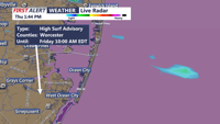
A High Surf Advisory remains in effect from 7 p.m. Thursday evening to
10 a.m. Friday.
A High Surf Advisory remains in effect from 7 p.m. Thursday evening to
10 a.m. Friday. Large breaking waves of 8 to 10 feet can be expected in the surf zone. This includes coastal Worcester County, including Ocean City. Conditions like this make for dangerous swimming and surfing and potential for beach erosion.
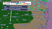
The Coastal Flood Warning remains in effect from early Thursday night until 10 a.m. Friday. Dorchester, Wicomico and Somerset counties should watch for two feet of inundation in low lying areas. This could mean widespread flooding for vulnerable areas and an elevated threat of property damage to homes and businesses near the waterfront and shoreline. Water will be around two feet above ground level in some areas resulting in a sufficient depth close to roads, homes and businesses.

The Coastal Flood Warning remains in effect from early Thursday night until 10 a.m. Friday. Dorchester, Wicomico and Somerset counties should watch for two feet of inundation in low lying areas.
