site-logo
Facebook Instagram Threads X LinkedIn YouTube LinkedIn
  • Sign Up
  • Log In
  • Dashboard
  • Logout
    • My Account
    • Dashboard
    • Profile
    • Saved items
    • Logout
Home
  • About Us
  • Contact Us
  • Programming
  • Our Team
  • Submit a Tip
  • Newsletters
  • Apps
CoastTV Poll
News
  • Local News
  • Regional News
  • National News
  • International News
  • Feel Good
  • Police and Fire
  • Education
  • Politics
  • Business
  • Area Development
  • Environment
  • Health
  • Roadwork
  • Things to Do
  • Latest Newscasts
  • Featured Videos
  • Immigration
Weather
  • Latest Forecast
  • Weather Cameras
  • Closings
  • Phone
  • Weather101
Traffic
Features
  • Olympics
  • Cool Things
  • Coastal Connections
  • The Ties That Bind Us
  • Week in Review
  • Seaside Guides
  • Pet of the Day
  • Petey the Peacock
  • Salutes
  • Soaring Over the Shore
  • Umbrella Giveaway
  • Photo Booth
Delmarva Sports Network
CoastLife
Radio
  • WDEL
  • Coast Country 103.9 & 106.3
  • 93.5 The Beach
  • BIG 107.7
  • 102.5 WBOC
  • 107.1 The Duck
  • 100.9% Classic Country
  • 93.7 WSTW
  • WXCY 103.7 & 96.9
  • WCEI 96.7
  • 94.3 WINX
  • Watch Live
  • Apps
  • Contact Us
  • My Account
  • Sign Up
  • Log In
  • Dashboard
  • Logout
    • My Account
    • Dashboard
    • Profile
    • Saved items
    • Logout
Facebook Instagram Threads X LinkedIn YouTube LinkedIn
  • 63° Rain
    • Milton, DE (19968)

      Today

      Windy with strong thunderstorms this evening followed by occasional showers overnight. Storms could contain damaging winds. Low 33F. SSW winds shifting to WNW at 20 to 30 mph. Chance of rain 100%..

      Tonight

      Windy with strong thunderstorms this evening followed by occasional showers overnight. Storms could contain damaging winds. Low 33F. SSW winds shifting to WNW at 20 to 30 mph. Chance of rain 100%.

      Updated: March 16, 2026 @ 5:09 pm

    • Full Forecast
site-logo
Monday, March 16, 2026
Watch Live

Newscast Schedule

View Programming Schedule
site-logo
  • 63°
  • Home
  • News
    • Local News
    • Regional News
    • National News
    • International News
    • Feel Good
    • Police and Fire
    • Education
    • Politics
    • Business
    • Area Development
    • Roadwork
    • Environment
    • Health
    • Things to Do
    • Latest Newscasts
    • Video
    • Immigration
  • Weather
    • Weather Cameras
    • Umbrellas
    • Closings
    • Weather Phone
    • Weather101
  • Traffic
  • Delmarva Sports Network
  • CoastLife
  • Features
    • Cool Things to Do
    • Coastal Connections
    • The Ties That Bind Us
    • Week in Review
    • Seaside Guides
    • Pet of the Day
    • Petey the Peacock
    • Salutes
    • Umbrella Giveaway
    • Photo Booth
    • Soaring Over the Shore
    • Olympics
  • Poll
  • About Us
    • About CoastTV
    • Bios
    • Contact Us
    • Newsletters
    • Apps
    • Channel Finder
    • Careers
    • Internships
  • Submit a tip
Broadcast Schedule

On air schedule

Weather Alert

Weather Alert

The National Weather Service in Mount Holly NJ has issued a

* Special Marine Warning for...
Lower Delaware Bay...
Coastal waters from Little Egg Inlet NJ to Fenwick Island DE out 20
nm...
Outer waters from Great Egg Inlet NJ to Fenwick Island DE out 20 to
40 nm...

* Until 615 PM EDT.

* At 518 PM EDT, severe thunderstorms capable of producing
waterspouts were located along a line extending from 6 nm west of
Indian River Inlet Bridge to 9 nm south of Five Fathoms Buoy,
moving northeast at 50 knots.

HAZARD...Waterspouts and wind gusts 34 knots or greater.

SOURCE...Radar.

IMPACT...Waterspouts can easily overturn boats and create locally
hazardous seas. Small craft could be damaged in briefly
higher winds and suddenly higher waves.

* Locations impacted include...
Atlantic City, Five Fathoms Buoy, Buoy 2fb, Fenwick Island, Buoy
4fb, Buoy 3fb, Cape Henlopen, Great Egg Reef, Ocean City Reef,
Indian River Inlet Bridge, Overfalls Shoal, The Lump, 28-
Mile Wreck, Brigantine, Bethany Beach, Atlantic City Reef, Great
Egg Inlet, Rehoboth Beach, Cape May Point, and Wildwood.

PRECAUTIONARY/PREPAREDNESS ACTIONS...

A Tornado Watch remains in effect until 700 PM EDT for southern
Delaware...southern New Jersey...and the adjacent coastal waters.

Move to safe harbor until hazardous weather passes.

&&


WATERSPOUT...POSSIBLE;
HAIL...0.00IN;
WIND...>34KTS

Weather Alert

TORNADO WATCH 68 REMAINS VALID UNTIL 7 PM EDT THIS EVENING FOR
THE FOLLOWING AREAS

IN DELAWARE THIS WATCH INCLUDES 3 COUNTIES

IN CENTRAL DELAWARE

KENT

IN NORTHERN DELAWARE

NEW CASTLE

IN SOUTHERN DELAWARE

SUSSEX

IN MARYLAND THIS WATCH INCLUDES 4 COUNTIES

IN NORTHEAST MARYLAND

CAROLINE              KENT                  QUEEN ANNE'S
TALBOT

IN NEW JERSEY THIS WATCH INCLUDES 14 COUNTIES

IN CENTRAL NEW JERSEY

MERCER                MONMOUTH

IN NORTHERN NEW JERSEY

HUNTERDON             MIDDLESEX             MORRIS
SOMERSET

IN SOUTHERN NEW JERSEY

ATLANTIC              BURLINGTON            CAMDEN
CAPE MAY              CUMBERLAND            GLOUCESTER
OCEAN                 SALEM

IN PENNSYLVANIA THIS WATCH INCLUDES 4 COUNTIES

IN SOUTHEAST PENNSYLVANIA

BUCKS                 DELAWARE              MONTGOMERY
PHILADELPHIA

THIS INCLUDES THE CITIES OF ATLANTIC CITY, CAMDEN, CENTREVILLE,
CHERRY HILL, CHESTERTOWN, DENTON, DEPTFORD, DOVER, DOYLESTOWN,
EAST BRUNSWICK, EASTON, EDISON, FLEMINGTON, FREEHOLD, GEORGETOWN,
GLASSBORO, HAMMONTON, MEDIA, MILLVILLE, MOORESTOWN, MORRISTOWN,
MOUNT HOLLY, NEW BRUNSWICK, NORRISTOWN, NORTH BRUNSWICK TOWNSHIP,
OCEAN CITY, PENNSVILLE, PERTH AMBOY, PHILADELPHIA, SAYREVILLE,
SOMERSET, TOMS RIVER, TRENTON, AND WILMINGTON.

Weather Alert

TORNADO WATCH 68 REMAINS VALID UNTIL 7 PM EDT THIS EVENING FOR
THE FOLLOWING AREAS

THIS WATCH INCLUDES THE FOLLOWING ADJACENT COASTAL WATERS

DELAWARE BAY WATERS NORTH OF EAST POINT NJ TO SLAUGHTER BEACH DE
DELAWARE BAY WATERS SOUTH OF EAST POINT NJ TO SLAUGHTER BEACH DE

Weather Alert

...GALE WARNING REMAINS IN EFFECT UNTIL 6 AM EDT TUESDAY...

* WHAT...Southwest winds 20 to 30 kt with gusts up to 45 kt and
very rough waters.

* WHERE...Delaware Bay waters north of East Point NJ to
Slaughter Beach DE and Delaware Bay waters south of East Point
NJ to Slaughter Beach DE.

* WHEN...Until 6 AM EDT Tuesday.

* IMPACTS...Strong winds will cause hazardous seas which could
capsize or damage vessels and reduce visibility.

PRECAUTIONARY/PREPAREDNESS ACTIONS...

Mariners should alter plans to avoid these hazardous conditions.
Remain in port, seek safe harbor, alter course, and/or secure the
vessel for hazardous conditions.

&&

Weather Alert

...COASTAL FLOOD ADVISORY REMAINS IN EFFECT UNTIL 2 AM EDT
TUESDAY...

* WHAT...Up to one foot of inundation above ground level expected
in low-lying areas near shorelines and tidal waterways.

* WHERE...Inland Sussex and Delaware Beaches.

* WHEN...Until 2 AM EDT Tuesday.

* IMPACTS...Flooding of lots, parks, and roads with only
isolated road closures expected.

* ADDITIONAL DETAILS...South winds will continue to increase this
evening, preventing water from draining out of Rehoboth Bay and
Little Assawoman Bay at low tide. The elevated water levels may
lead to areas of minor tidal flooding impacts, especially along
the northern ends of the bays.

PRECAUTIONARY/PREPAREDNESS ACTIONS...

A Coastal Flood Advisory means that minor tidal flooding is
expected. Minor tidal flooding often results in some road
closures. Usually, the most vulnerable roadways will flood.

Do not leave your vehicle at a location that is prone to tidal
flooding. Do not drive your vehicle through flood waters. The
water may be deeper than you think it is. You will be putting
yourself in danger and your vehicle may be damaged, leading to
costly repairs.

Visit the National Water Prediction Service at
https://water.noaa.gov/wfo/phi for additional water level and
flood impact information for your local tide gauge.

&&

Time of high total tides are approximate to the nearest hour.

Delaware Bay at Lewes
MLLW Categories - Minor 6.0 ft, Moderate 7.0 ft, Major 8.0 ft
MHHW Categories - Minor 1.3 ft, Moderate 2.3 ft, Major 3.3 ft

Total      Total    Departure
Day/Time    Tide       Tide     from Norm   Flood
ft MLLW    ft MHHW       ft      Impact
--------  ---------  ---------  ---------  --------
16/08 PM     4.4       -0.2        0.7       None
17/09 AM     3.8       -0.9       -0.4       None
17/09 PM     3.7       -1.0       -0.3       None
18/09 AM     4.3       -0.4       -0.2       None
18/09 PM     4.6       -0.0        0.3       None
19/10 AM     5.1        0.5        0.7       None

&&

Weather Alert

...WIND ADVISORY REMAINS IN EFFECT UNTIL 2 AM EDT TUESDAY...

* WHAT...South winds 25 to 35 mph with gusts up to 50 mph expected.

* WHERE...Portions of central, northern, and southern Delaware,
northeast Maryland, central, northern, northwest, and southern New
Jersey, and east central, northeast, and southeast Pennsylvania.

* WHEN...Until 2 AM EDT Tuesday.

* IMPACTS...Gusty winds will blow around unsecured objects. Tree
limbs could be blown down and a few power outages may result.

PRECAUTIONARY/PREPAREDNESS ACTIONS...

Winds this strong can make driving difficult, especially for high
profile vehicles. Use extra caution.

Secure outdoor objects.

&&

Closings

Click here to view closings and delays

Advanced Search Close Search
From
To
Close Search
Cut fiber line knocks out phones and internet at Cape Henlopen schools
News

Cut fiber line knocks out phones and internet at Cape Henlopen schools

  • Torie Seagraves
  • Oct 20, 2025

A fiber line was cut Friday, disrupting landline phone and internet service at several buildings in the Cape Henlopen School District.

+2
Updated: Cape Henlopen School District looks to hold referendum again in May
News

Updated: Cape Henlopen School District looks to hold referendum again in May

  • Torie Seagraves and Mallory Metzner
  • Updated Apr 5, 2024

After a failed referendum on March 26, Cape Henlopen School officials have scheduled a meeting Thursday, April 11 with a possible vote on a May referendum on the agenda.

The Cape Henlopen School District picks a new location to expand
News

The Cape Henlopen School District picks a new location to expand

  • Torie Seagraves
  • Aug 30, 2023

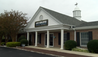
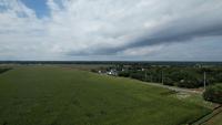
The Cape Henlopen School District has been clear it needs more space. As part of the school's expansion, means relocating the district office. It's selected a 103-acre parcel of land it wants to buy at the cost of $15.5 million.

Cape Henlopen School District talks plans to expand and move the District Office
News

Cape Henlopen School District talks plans to expand and move the District Office

  • Torie Seagraves
  • Updated Aug 18, 2023

LEWES, Del. - The Cape Henlopen School District is growing, but more students means they need more room.


site-logo
Facebook Instagram Threads X BlueSky YouTube LinkedIn

    Sections

    • Home
    • News
    • Weather
    • CoastLife
    • Delmarva Sports Network
    • Telemundo Delmarva

    Services

    • Contact Us
    • Submit a tip
    • Search
    • CoastTV Poll
    • Newsletter
    • Careers
    • Internships

    Browser Compatibility

    Your browser is out of date and potentially vulnerable to security risks.
    We recommend switching to one of the following browsers:

    Microsoft Edge Google Chrome Firefox
    © Copyright 2026 CoastTV One The Sq, Milton, DE  | Terms of Use  | Privacy Policy
    Powered by BLOX Content Management System from BLOX Digital.