




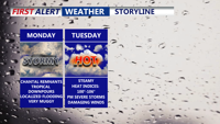
Starting Monday, Delmarva will enter a prolonged stretch of hot, humid, and stormy weather. The remnants of Tropical Storm Chantal will bring widespread showers and thunderstorms capable of downpours and localized flooding. Even the threat for severe storms Tuesday. As the week progresses, a stalled front and several disturbances will prolong unsettled conditions, with dangerous heat indices nearing 106 degrees and repeated rounds of storms expected into the weekend
From
To

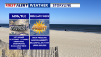
A stalled front lifting north will trigger rounds of thunderstorms across Delmarva starting Monday and lasting into Tuesday night. With temperatures climbing into the upper 80s to low 90s and abundant moisture, the atmosphere will become increasingly unstable. Forecast models point to a heightened risk of damaging wind gusts and localized flash flooding, especially Tuesday, when a Slight Risk for severe weather has been issued. Quieter and more pleasant weather is expected to settle in by midweek and continue through the Fourth of July holiday weekend.

Sunday brought oppressive heat and humidity fueled strong thunderstorms across Sussex County. Flash flooding quickly inundated coastal communities, while a microburst near Laurel generated wind gusts nearing 60 mph. Additional rounds of storms are expected Monday and Tuesday, with a heightened risk of damaging winds and flooding.