








DELMARVA -- Sunday evening brought the end of another sweltering day across Delmarva, as temperatures climbed into the low 90s and intense humidity blanketed the region. By late afternoon, powerful thunderstorms erupted across Sussex County, delivering torrential downpours and triggering Flash Flood Warnings that have since expired.
Areas from Indian River Inlet to Long Neck and Dewey Beach were hit hardest, picking up an estimated 2 to 3 inches of rain in a short window along Coastal Highway.

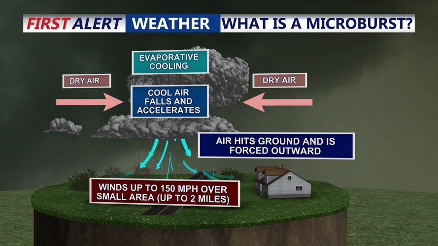
Reports of a microburst with wind gusts to 58 mph in Bethel, DE.
In southwestern Sussex County, a Severe Thunderstorm Warning accompanied reports of a microburst near Laurel and Bethel, with wind gusts measured at 58 mph. Flash flooding was reported in several low-lying spots.

Reports of a microburst occurred early Sunday evening in Bethel, DE.
Overnight, the storms are expected to end, though conditions will remain uncomfortable. Temperatures are forecast to dip only into the mid-70s under partly cloudy skies, while oppressive humidity lingers. A weak cold front stalled near Delmarva and southern New Jersey is expected to lift northward as a warm front Monday into Monday night. Another cold front will follow late Tuesday, bringing additional rounds of unsettled weather.

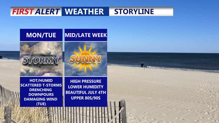
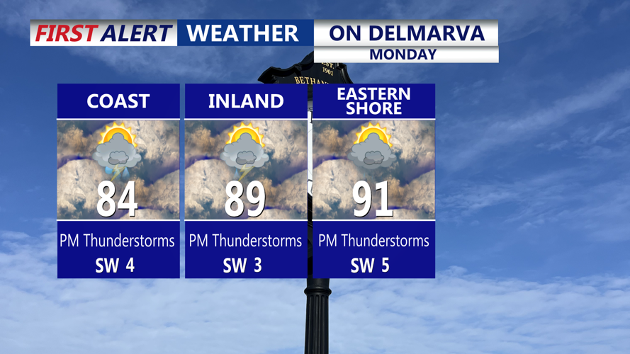
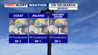
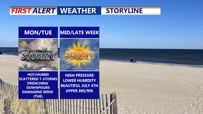
Monday features more hot and humid conditions with scattered showers and storms.
Expect highs on Monday to reach the upper 80s to around low 90s, with heat indices approaching close to 100 in some areas. Scattered showers and storms are possible through the afternoon, some of those storms could bring damaging winds and localized flash flooding. The Storm Prediction Center has placed most of the peninsula in a Marginal (Level 1 of 5) risk for severe thunderstorms Monday.
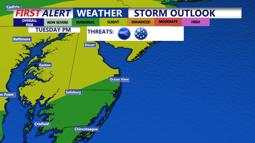
By Tuesday, the atmosphere is forecast to become even more unstable as the region moves into the warm sector ahead of the approaching front. Moderate destabilization under mostly sunny skies could produce widespread convection by afternoon. The Storm Prediction Center has placed most of the region in a a Slight (Level 2 of 5) risk Tuesday. Damaging wind gusts are the primary threat. The threat looks primarily into the evening based on the latest guidance.

Storm Prediction Center has placed a good chuck of the peninsula in a "Slight" risk (2 of 5) Tuesday afternoon-evening, damaging straight line winds is the primary threat.
Localized flash flooding remains a concern, as slow-moving storms could dump heavy rainfall over urban and coastal areas. Forecast models indicate precipitable water values rising to 2 to 2.5 inches, signaling the potential for efficient rainfall rates.
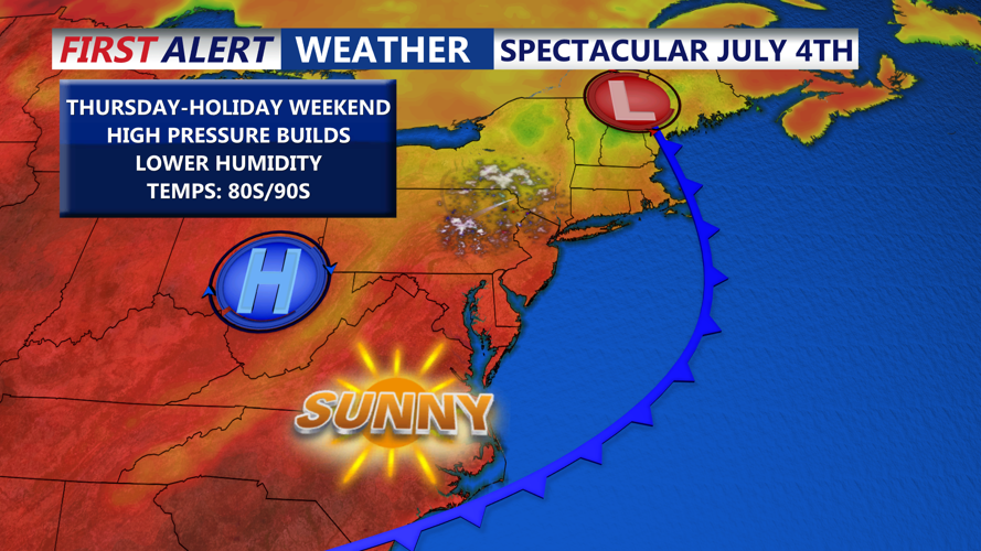
The severe threat is expected to diminish by late Tuesday night, but lingering showers may persist into Wednesday morning. Dew points will gradually lower behind the front, ushering in a stretch of calmer weather by Thursday and Friday. High pressure will build across the Mid-Atlantic in time for the Fourth of July holiday, delivering comfortable humidity and seasonable warmth heading into the weekend.

Cold front brings lower humidity and sunny skies for the 4th of July.
