


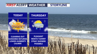
Delmarva begins a stretch of calmer weather today, with sunshine, lower humidity and seasonable temperatures continuing into the weekend.
From
To

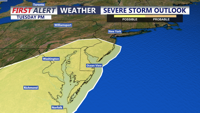
A quieter and less humid stretch begins today following Tuesday evening’s severe storms across Delmarva.

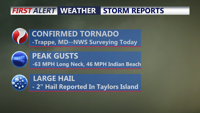
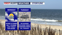
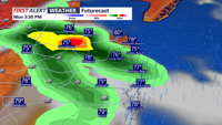
A warm and muggy Tuesday will bring multiple rounds of thunderstorms capable of producing damaging winds, torrential rainfall and localized flash flooding across Delmarva.

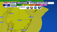
Scattered strong storms are possible across Delmarva today, but Tuesday is expected to bring the greatest threat for severe weather and flash flooding.

A few showers and thunderstorms today, with a greater threat for severe weather Tuesday.

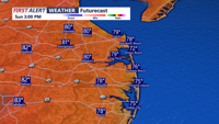
A nice end to the weekend, then increasing chances for storms early next week.

A nice end to the weekend, then increasing storm chances next week.

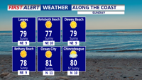
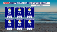
The pleasant late July weather continues the rest of the weekend.

A few showers early, otherwise a nice start to the weekend across Delmarva.


The Delaware Food is Medicine Committee is set to unveil the path towards a statewide 'Food is Medicine' system on Tuesday, July 28 on the Delaware State Fairgrounds from 10 a.m. to 11 a.m.