




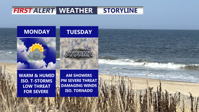
DELMARVA -- An active and unsettled weather pattern begins across the peninsula Monday, with scattered showers and thunderstorms expected to develop during the afternoon and evening.

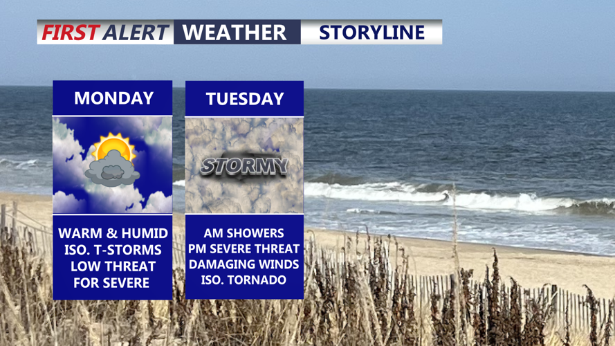
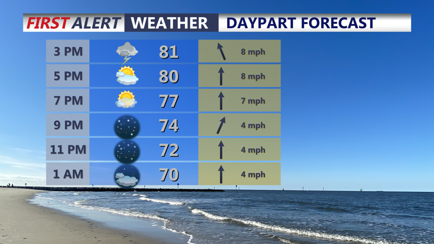
Partly cloudy skies, warm and humid, isolated pop-up t-storms this afternoon into the early evening.
Storms will be hit or miss, meaning some communities could receive heavy rain while nearby locations remain dry. The entire Delmarva Peninsula is under a Marginal Risk, level 1 out of 5, for severe thunderstorms.
The atmosphere will contain enough instability for a few storms to become strong. The primary concerns will be isolated damaging wind gusts, frequent lightning and brief heavy downpours. Storms may initially develop near sea-breeze and Chesapeake Bay-breeze boundaries before moving across portions of the peninsula.
High temperatures will reach the low to mid-80s inland, with upper 70s expected along the beaches. Monday night will be partly cloudy, mild and increasingly muggy, with lows in the upper 60s to low 70s.
Tuesday is expected to bring the most impactful weather of the week. Numerous showers and thunderstorms could develop throughout the day as low pressure and an approaching cold front draw warm, moisture-rich air northward across Delmarva.
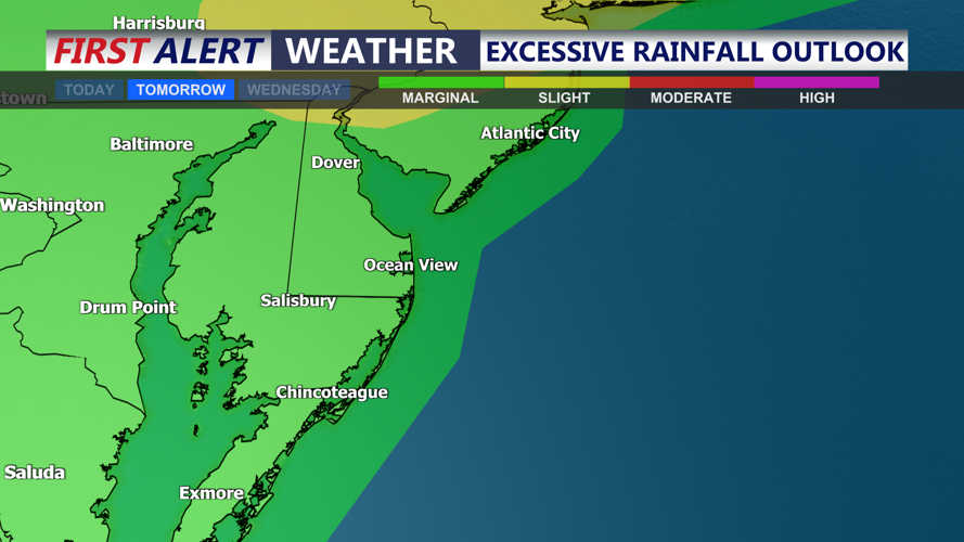
Humidity will rise sharply, with atmospheric moisture reaching levels capable of supporting torrential rainfall. Repeated storms over the same communities could produce localized flash flooding, especially in urban areas, locations with poor drainage and places that receive heavy rain Monday.
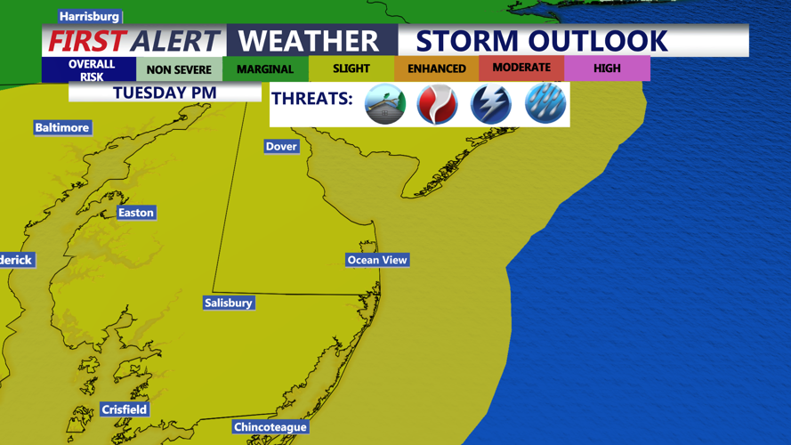
Delmarva is under a Slight Risk, level 2 out of 5, for severe thunderstorms Tuesday. Damaging wind gusts will be the main severe weather concern, but an isolated tornado can't be ruled out. although the overall threat will depend on the timing of earlier storms and the amount of instability that develops. Highs Tuesday in the low to mid 80s.

Slight risk of severe storms Tuesday (2 of 5) risk, damaging winds, isolated tornado and flash flooding possible.
Heavy rainfall and flash flooding could ultimately become a greater concern than severe winds. Residents should remain alert for rapidly changing conditions and avoid driving through flooded roads.

Flash flooding is possible Tuesday, with a marginal risk of excessive rainfall for all of Delmarva.
Scattered showers and thunderstorms will remain possible Wednesday as the storm system slowly moves offshore. The severe weather threat should decrease, but additional heavy rainfall could aggravate flooding in areas that receive repeated downpours earlier in the week.
Storm chances will gradually decline Thursday and Friday, although isolated showers and thunderstorms will remain possible. Delmarva may briefly experience drier weather Saturday before another weather system approaches by Sunday with seasonable highs in the mid to upper 80s.
