




DELMARVA -- A warm, humid and increasingly stormy day is expected across the peninsula today as a powerful weather system approaches the Mid-Atlantic.
Partly sunny skies will allow temperatures to climb into the low to mid-80s. A warm front lifting northward will strengthen southerly winds and pull an exceptionally moist air mass across Delmarva.
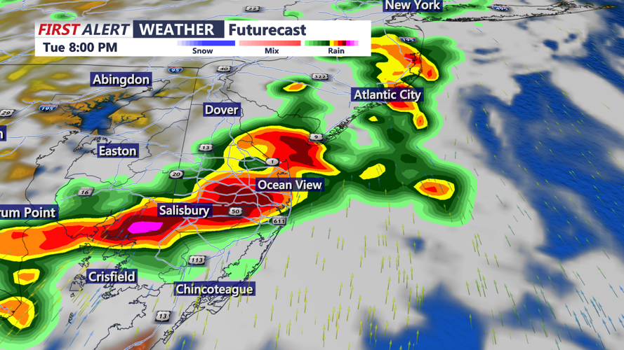
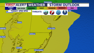
Showers and thunderstorms are expected to become widespread after 3 p.m., with the greatest threat continuing through approximately 9 p.m. Some storms could linger or redevelop through 11 p.m. as a strong cold front approaches from the west.

Strong to severe storms will push through the region late this afternoon through the evening.
Multiple rounds of storms will be possible, increasing the risk of both severe weather and flash flooding.
Atmospheric moisture levels will be unusually high for late July, allowing storms to produce extremely heavy rainfall. Rainfall rates of 1 to 3 inches per hour will be possible during the strongest storms.

The threat of flash flooding is high, storms will have the capability of producing 1 to 3 inch per/hour rainfall rates.
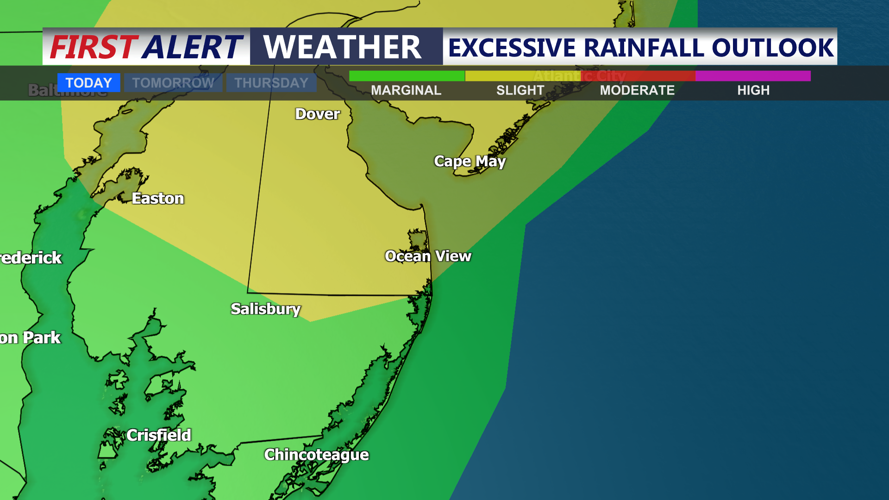
Most of Delmarva is under a Slight Risk, or Level 2 out of 4, for excessive rainfall. Urban communities, locations with poor drainage and areas that received heavy rain Monday will be especially vulnerable to rapid flooding.
Drivers should never attempt to cross a flooded roadway. Water could rise quickly during the afternoon and evening commute.
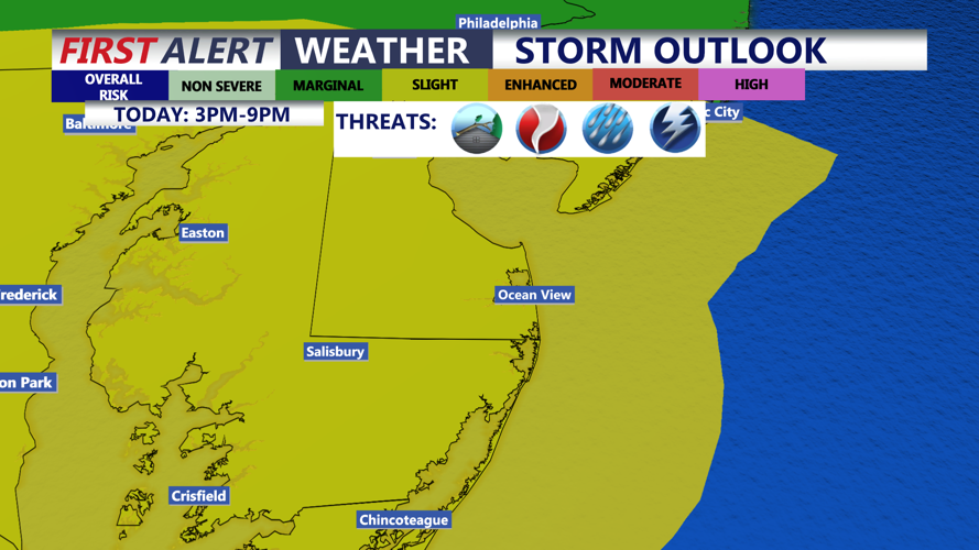
A Slight Risk, or Level 2 out of 5, for severe thunderstorms also covers much of Delmarva. The greatest severe weather threat will be across the southern half of the peninsula, where greater instability and stronger wind shear are expected.
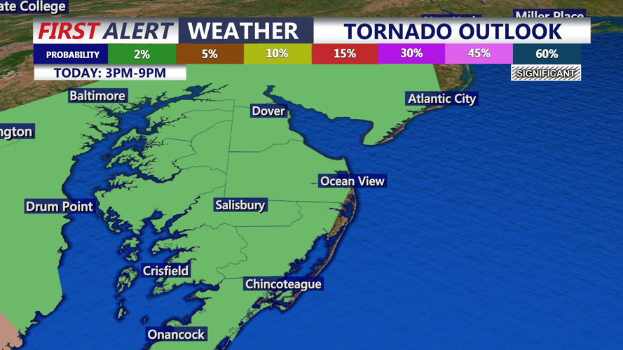
Damaging wind gusts will be the primary hazard. An isolated tornado cannot be ruled out. Frequent lightning and torrential rain will accompany many of the storms.

A brief tornado cannot be ruled out with storms late this afternoon-evening.
The strong cold front will move through tonight, but another front could cross the region Wednesday. No organized severe weather threat is currently expected Wednesday.
Heading down to Chincoteague, for the 101st Pony Swim, looking at partly cloudy skies and temperatures in the low 70s. Mostly sunny skies should return Wednesday with highs in the mid-80s.
Thursday will be partly cloudy with a small chance of a stray afternoon shower.
A much quieter pattern arrives by Friday as high pressure builds toward Delmarva. Friday looks pleasant with mostly sunny skies and highs in the low to mid-80s. Generally dry and comfortable weather is expected to continue into the weekend with highs in the upper 80s.
