




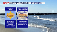
Delmarva started the day with a cold morning, with many spots away from the coast in the 20s, but sunshine and lighter winds will help temperatures recover into the mid to upper 50s and near 60 this afternoon. Milder air builds in tonight and Wednesday, with highs surging into the upper 60s and low 70s. Even warmer weather arrives Thursday and Friday before a cooler pattern and the chance for beneficial widespread rain return this weekend.
From
To


Today stays warm and sunny across Delmarva, but temperatures step down from yesterday’s record highs. Cooler air arrives near the coast Saturday as a backdoor front pushes in, while inland areas stay milder. Minor tidal flooding is expected along the Delaware coast and Delaware Bay Saturday evening into Saturday night, followed by showers, a few thunderstorms, and a sharp cool down late Saturday night into Sunday. Much colder air settles in early next week, with widespread frost or freeze conditions likely Monday night into Tuesday morning.

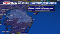
A cool and breezy Tuesday is ahead across Delmarva with afternoon highs in the mid 50s and northwest wind gusts of 30 to 35 mph. The combination of dry air and gusty winds will create an elevated risk for fire spread, though recent rainfall may help limit the overall threat. Colder air settles in tonight and lingers through Thursday morning, bringing freeze and frost concerns away from the immediate coast. After the chilly stretch, temperatures rebound quickly late week, with 70s returning by Friday and 80s possible early next week.