


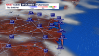
Stifling heat along with the threat for severe weather exists for the rest of the week.
From
To

Meteorologist Chris Mastrobuono has the latest on a foggy misty start to our Memorial Day, milder temperatures in the 70s today, another round…

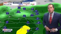
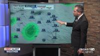
Meteorologist Chris Mastrobuono has the details on the last hot and humid day before a cold front puts an end to this heatwave, an isolated se…

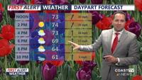
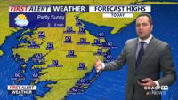
Meteorologist Chris Mastrobuono has the latest on a mostly sunny breezy day with highs in the low to mid 70s, winds will gust 35 to 40 mph, sh…

Meteorologist Chris Mastrobuono has the latest on a beautiful breezy day with highs in the mid 70s, tracking a round of showers and isolated t…

Meteorologist Chris Mastrobuono has the latest on a picture perfect day on Delmarva, chilly start in the 40s, upper 60s to near 70 this aftern…

Meteorologist Chris Mastrobuono has the latest on a soggy raw Monday, temperatures in the 50s with showers through the afternoon, clearing int…

Meteorologist Chris Mastrobuono has the latest on a chance of midday showers, mild breezy day under mostly cloudy skies, highs in the mid 70s,…

Meteorologist Chris Mastrobuono has the latest on temperatures in the 50s this morning, mostly cloudy skies mild highs in the mid to upper 60s…

Meteorologist Chris Mastrobuono has the latest on some cold temperatures in the 30s this morning, partly sunny skies highs in the mid 60s, can…