


Delmarva will see a dry and gradually warming forecast beginning today, with inland temperatures in the 70s and cooler conditions along the coast. A high risk for dangerous rip currents continues from Delaware beaches south to Ocean City and Chincoteague. High pressure keeps the region dry through the end of the week, with some locations potentially reaching the low 90s by Friday and Saturday.
From
To

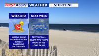
Delmarva faces moderate coastal flooding Friday evening as we deal with residual impacts of Hurricane Erin, with warnings in effect through early Saturday. Skies will clear overnight with lows in the 50s inland and low 60s near the coast. Saturday brings sunshine and highs in the low to mid 80s, followed by rising humidity ahead of a cold front Sunday into Monday that could spark scattered showers and thunderstorms. Cooler, drier air returns by midweek, with highs in the 70s and lows in the 50s.