


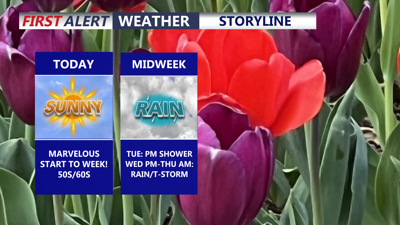
DELMARVA -- Today brings a marvelous start to the week across Delmarva after a gloomy and raw weekend. Canadian high pressure will build into the region, delivering wall-to-wall sunshine and much more pleasant conditions, even though afternoon highs will remain below average.

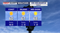
Mostly sunny skies and highs in the upper 50s/low 60s at the coast, warmer inland and on the Mid-Shore.
Temperatures today will reach the mid to upper 60s for inland areas, while coastal communities stay cooler in the upper 50s to low 60s. Northeast winds will be noticeable at times, with gusts around 20 to 25 mph.

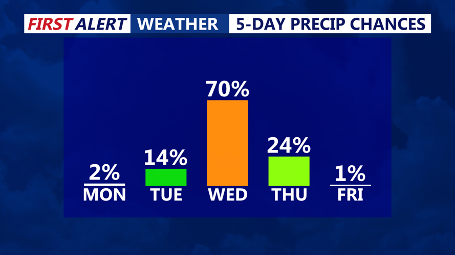
Isolated shower Tuesday, better chance for rain and thunderstorms comes Wednesday afternoon-night.
Tonight will turn partly cloudy and chilly, with lows falling into the upper 30s to low 40s.
By Tuesday, a weak frontal boundary will approach Delmarva late in the day, bringing a chance for light rain. However, the chances for meaningful rainfall appear to be decreasing as high pressure remains nearby and the front largely washes out across the region. Tuesday will feature partly sunny skies with highs in the mid to upper 60s.
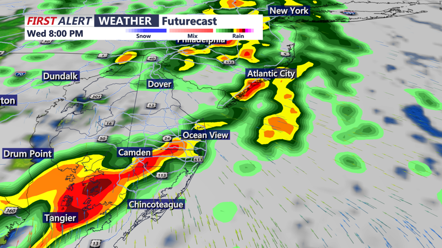
A stronger system is still expected to arrive late Wednesday into early Thursday, bringing more widespread showers and perhaps an isolated thunderstorm across Delmarva. Rainfall amounts from Wednesday evening through Thursday morning are expected to range from around 0.75 to 1.00 inches.

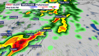
A cold front will bring the chance of strong to possibly severe storms Wednesday evening.
Some thunderstorms could become strong to severe, with damaging winds as the primary threat. The Storm Prediction Center has placed the area in a marginal risk, level 1 out of 5. Highs Wednesday will again reach the mid to upper 60s.
Behind the front, Delmarva turns dry and cooler on Thursday with highs in the low 60s. Dry and below-average conditions are expected to continue Friday and into the weekend.
