


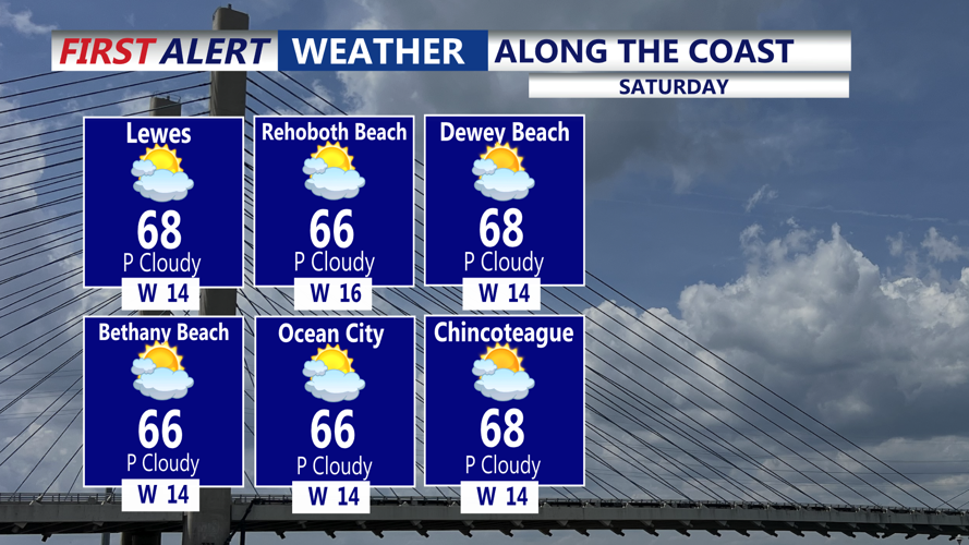

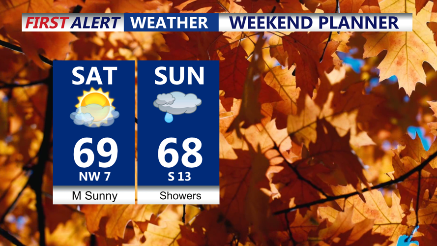


DELMARVA- A few morning showers, otherwise sunshine today allowing afternoon highs to reach the mid to upper 60s today and Sunday. We'll see a better chance of showers Sunday. Then a taste of winter early next week.

This morning a few light showers are possible, otherwise weak high pressure will settle back over the area, leading to partly sunny skies and continued warmth. Temperatures will rise well into the 60s, possibly touching 70 degrees in some inland spots later today. Clouds will return late Saturday night as another low pressure system develops in the Ohio Valley, keeping overnight temperatures mild, in the 40s to near 50.

Sunday will start cloudy with periods of rain even an isolated t-storm possible by midday, although forecast models differ on how long the rain persists. Regardless, temperatures should stay mild, reaching 68-72 before a strong cold front pushes through late Sunday night.

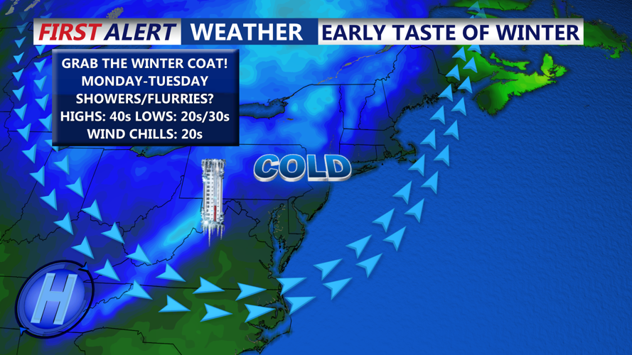
Behind the front, a blast of Canadian air will drop temperatures sharply. Monday will feel noticeably cooler, with highs around 50 degrees, and gusty winds making it feel even colder. By Tuesday, highs will struggle to reach the 40s, and overnight lows will dip below freezing. A few flurries or sprinkles can’t be ruled out, but the main story will be the cold and wind. Wind chills Tuesday morning in the 20s.

The chill won’t last long, temperatures are expected to rebound into the 50s by midweek as high pressure shifts south and a westerly flow returns, bringing calmer and slightly warmer conditions to Delmarva.