


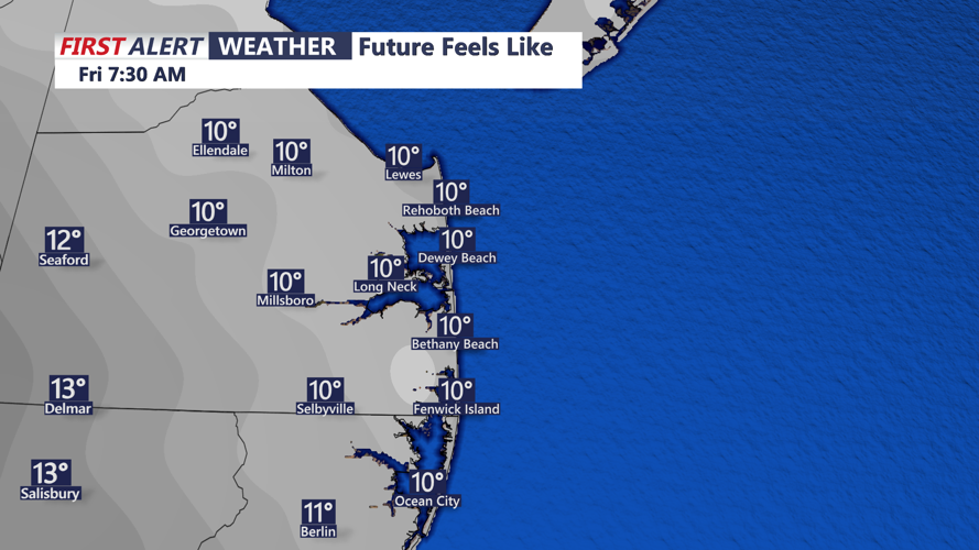


DELMARVA - High pressure will begin building over Sussex County and the Ocean City region late Thursday night, following a quick-moving system that could bring brief snow showers and reduced visibility earlier in the evening. As the system exits offshore, cold air will rush in, and winds will pick up, with gusts between 20 and 30 mph. Overnight temperatures will drop into the teens and low 20s, with wind chills dipping into the single digits.
By Friday morning, skies will clear, but gusty northwest winds will persist, with gusts potentially reaching 30 to 35 mph. Despite abundant sunshine, temperatures will struggle to climb above the low to mid-30s, keeping wind chills mostly in the 20s.
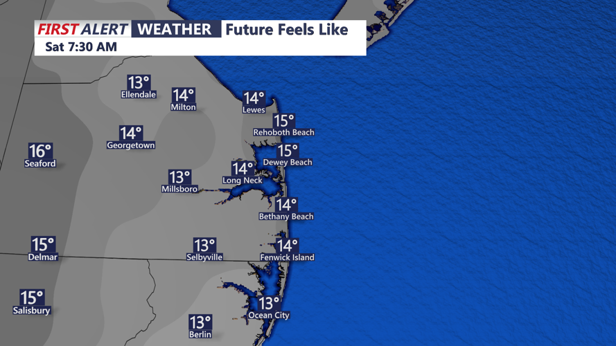
Heading into Friday night, high pressure will settle into the region, leading to a calmer and colder night with temperatures once again dropping into the teens and low 20s. Winds will begin to subside, allowing for a more tranquil start to the weekend.
The weekend itself will bring a noticeable shift toward more seasonable weather. On Saturday, highs will reach the upper 30s to low 40s under mostly sunny skies, while Sunday will see a further rise into the low 40s north to upper 40s south. Overnight lows will also trend warmer, staying in the 20s across the region.
While a few weak disturbances may bring periods of cloud cover, no significant weather systems are expected through the weekend. Looking ahead to next week, temperatures are expected to rise above normal, with highs in the upper 40s to mid-50s. A few weak weather systems could bring scattered rain showers, though nothing impactful is currently forecast.