


Today brings unseasonably warm weather to Delmarva with highs in the mid 80s under mostly sunny skies, though areas near the bay and ocean will stay a bit cooler in the upper 70s to low 80s. Georgetown and Salisbury could come close to their daily record highs of 87 degrees. The warmth continues tonight and intensifies Wednesday, when record highs are likely as temperatures approach 90. Conditions stay well above normal through the weekend before shower and thunderstorm chances return Sunday ahead of a strong cold front. Much cooler air arrives next week with highs falling back into the 50s and 60s.
From
To

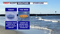
Today brings a pleasant and mild start to the week across Delmarva with mostly cloudy skies, breezy southwest winds, and highs near 80 inland, while beach communities stay in the mid to upper 70s. A weak disturbance could spark an isolated light shower, mainly north and west of the peninsula. Warmer air then builds in through midweek and into the weekend, sending temperatures 15 to 30 degrees above average with some inland spots potentially reaching 90 degrees for the first time this year.


Today stays below average across Delmarva with partly sunny skies, highs in the upper 30s to low 40s, and a cold east-northeast wind off the ocean keeping conditions raw. Tonight turns partly cloudy with lows in the upper 20s to low 30s. The chill lingers Thursday before a warmer trend arrives Friday, the first day of spring, with highs near 60. Even warmer air builds in for the weekend, pushing temperatures into the 60s Saturday and low 70s inland Sunday before showers and cooler air return early next week.