


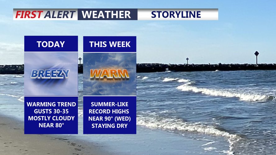


DELMARVA -- Today starts off pleasant and mild across Delmarva with mostly cloudy skies and a breezy southwest wind. Afternoon highs will climb to around 80 degrees away from the coast, while beach towns remain a little cooler in the mid to upper 70s.

Mostly cloudy warm and breezy, cooler at the coast, can't rule out a spotty shower primarily northern portions of the peninsula.
Winds may gust as high as 35 mph at times, adding a noticeable breeze through the day. A weak disturbance passing by the region could also bring a slight chance for a light shower, mainly north and west of the peninsula, although an isolated stray shower cannot be completely ruled out anywhere. Tonight, skies turn partly cloudy with mild overnight lows settling into the upper 50s and low 60s.
The warm pattern continues Tuesday with partly cloudy skies and highs reaching the low to mid 80s. From there, a significant warmup is expected to take hold through the rest of the week and into the upcoming weekend. With high pressure anchored over the Atlantic and a warm front lifting well north of the Mid-Atlantic, temperatures are forecast to run 15 to 30 degrees above average. Inland areas could see upper 80s to low 90s by Wednesday and possibly Thursday. If temperatures reach 90 degrees, it would mark the first 90-degree day of the year and the first since early September.

Record highs are likely on Wednesday.
As is often the case in spring, communities along and near the coast will stay noticeably cooler because of chilly ocean water and the daily sea breeze.

Ridge of high pressure bringing unseasonably warm air to the region right through the week.
Even with a weak front moving through late Thursday night into Friday morning, temperatures are expected to remain well above normal right through the weekend, with highs mainly in the upper 70s to mid 80s. The next better chance for showers arrives Sunday night as a stronger cold front moves through, followed by cooler temperatures early next week.
