




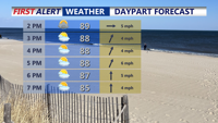
A stalled front across Delmarva Sunday afternoon will keep heat and isolated storms in the forecast to start the week. By Tuesday, a stronger cold front brings the potential for severe thunderstorms. After midweek, high pressure settles in, leading to more comfortable conditions and pleasant weather just in time for the Fourth of July holiday weekend.
From
To

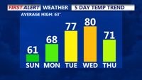
High pressure will maintain clear, dry, and sunny conditions across the Delmarva Peninsula through the beginning of the week. Expect seasonable temperatures on Sunday before a warming trend takes hold on Monday and Election Day. A weak cold front moving through midweek could bring some clouds and a slight chance of drizzle, with a return to cooler temperatures by Friday.

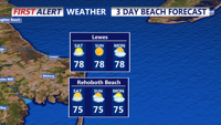
Expect a mild and pleasant weekend across Delmarva with sunny skies and comfortable humidity levels. Highs will range from the upper 70s to upper 80s on Saturday, slightly cooler on Sunday and Monday. Light winds and occasional morning fog are anticipated. Midweek, there is a potential for increased cloudiness and shower chances due to possible tropical development off the southeast coast.