




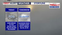
A stalled front keeps Delmarva dreary and foggy today, with the coolest, foggiest weather hugging the coast while inland areas briefly break into sunshine and warmer temperatures. Fog and drizzle linger into tonight and early Friday, then a backdoor cold front reinforces cooler, cloudier conditions. The pattern flips this weekend as warmer air pushes back in, turning noticeably milder Sunday and especially early next week with a few chances for showers and even a thunderstorm.
From
To

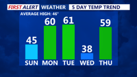
Seasonable conditions today, with highs in the mid-40s and increasing clouds as a warm front approaches. Monday brings much milder temperatures, with the upper 50s to low 60s. A cold front moves through late Monday night, keeping Tuesday’s highs similar to Monday but occurring earlier in the day. By midweek, a more active pattern develops, with a low-pressure system bringing widespread precipitation Wednesday through Thursday night.

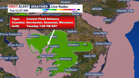
Light rain and clouds will dominate Delmarva on Wednesday, with steadier rain arriving Wednesday night into Thursday as a significant low-pressure system impacts the region.