



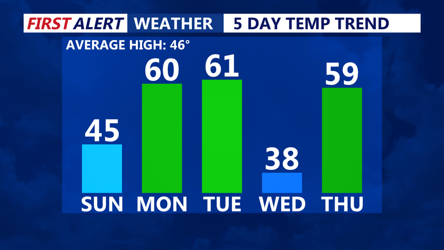

DELMARVA -- A mixed bag of weather in the coming days, with a mild start leading into an unsettled midweek. High pressure will remain over the region this morning, but as the day progresses, it will shift northeast. A warm front will begin lifting north, increasing cloud cover by the afternoon. Temperatures will reach the mid-40s, accompanied by easterly winds that will add a slight chill to the air. Overnight, lows will settle in the mid-30s as the front continues advancing.
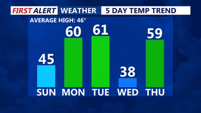
The start of the work week will see mild conditions upper 50s or even low 60s, while locations north of the boundary may hover near 50 degrees.
A cold front will move through late Monday night into early Tuesday, bringing a brief cooldown. However, depending on the timing of the front, Tuesday’s high temperatures may occur early in the day, before dropping off later as cooler air moves in.

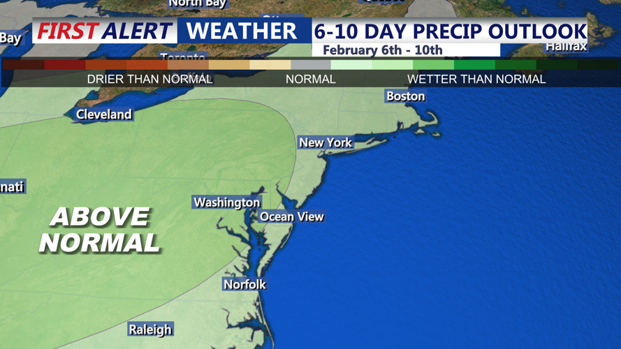
Slightly above normal precipitation.
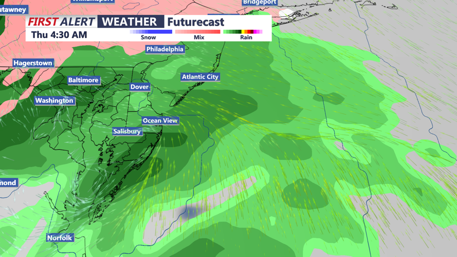
A low-pressure system will approach Wednesday through Thursday night, bringing widespread precipitation to the region. However, forecast models remain uncertain about the storm’s track and precipitation type. While rain appears likely, the exact timing and potential for any wintry mix remain difficult to pinpoint this far out.

Watching for a chance for rain Wednesday-Thursday.
High pressure may briefly return Friday into Saturday, offering a short window of dry weather. However, another system could quickly follow as early as Saturday, keeping an active pattern in place.
