


DELMARVA - This evening expect variable clouds, along with chilly and breezy conditions, as temperatures fall from the 50s into the 40s. Clouds will increase tonight as that high begins to depart offshore. Overnight lows will only fall into the mid to upper 40s under partly to mostly cloudy skies.
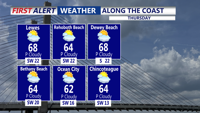
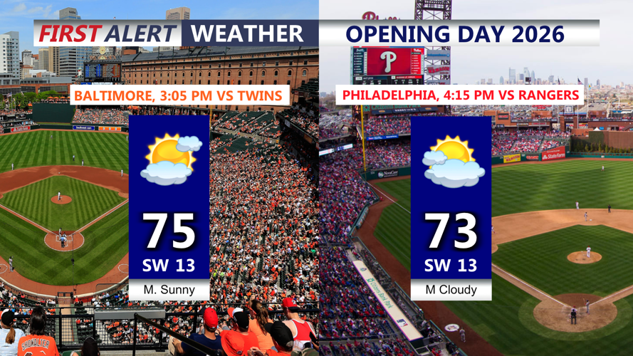
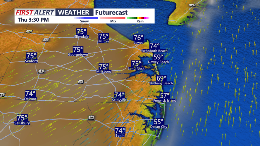
The warmth returns Thursday, highs are back into the low 70s under partly cloudy skies, cooler at the coast in the 50s and 60s. Perfect Opening Day baseball weather if you're one of the lucky ones venturing to games in Baltimore or Philadelphia. Enjoy!
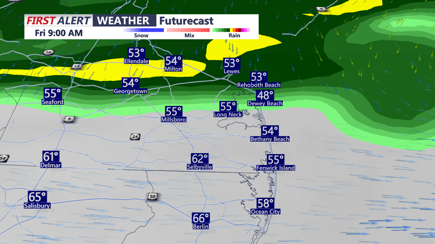
The next weather maker arrives Friday as a low pressure system tracks from the Northern Plains and Great Lakes into southern Ontario and Quebec, dragging a cold front toward the Mid-Atlantic. Ahead of the front, rain showers will spread southeastward across Delmarva through Friday morning. Showers should clear out by Friday evening.
Some modest elevated instability may develop with this system, so a rumble of thunder cannot be ruled out. Rainfall totals will generally range from a quarter inch to a half inch. Winds will also become a factor, with a breezy southwest flow on Thursday shifting northwesterly behind the front on Friday. Gusts of 25 to 35 mph are likely.
Once the cold front passes, colder air will surge into the region on Friday, causing temperatures to fall through the day. That sets the stage for a chilly weekend, with highs only reaching the 40s on Saturday. Conditions do look dry, however, as high pressure builds in behind the departing system. Temperatures should recover a bit on Sunday, returning closer to normal in the mid 50s.
Looking ahead, to the first week of April appears much warmer, with above-average highs climbing into the 70s and possibly nearing 80 degrees as Delmarva heads toward Easter Weekend.