


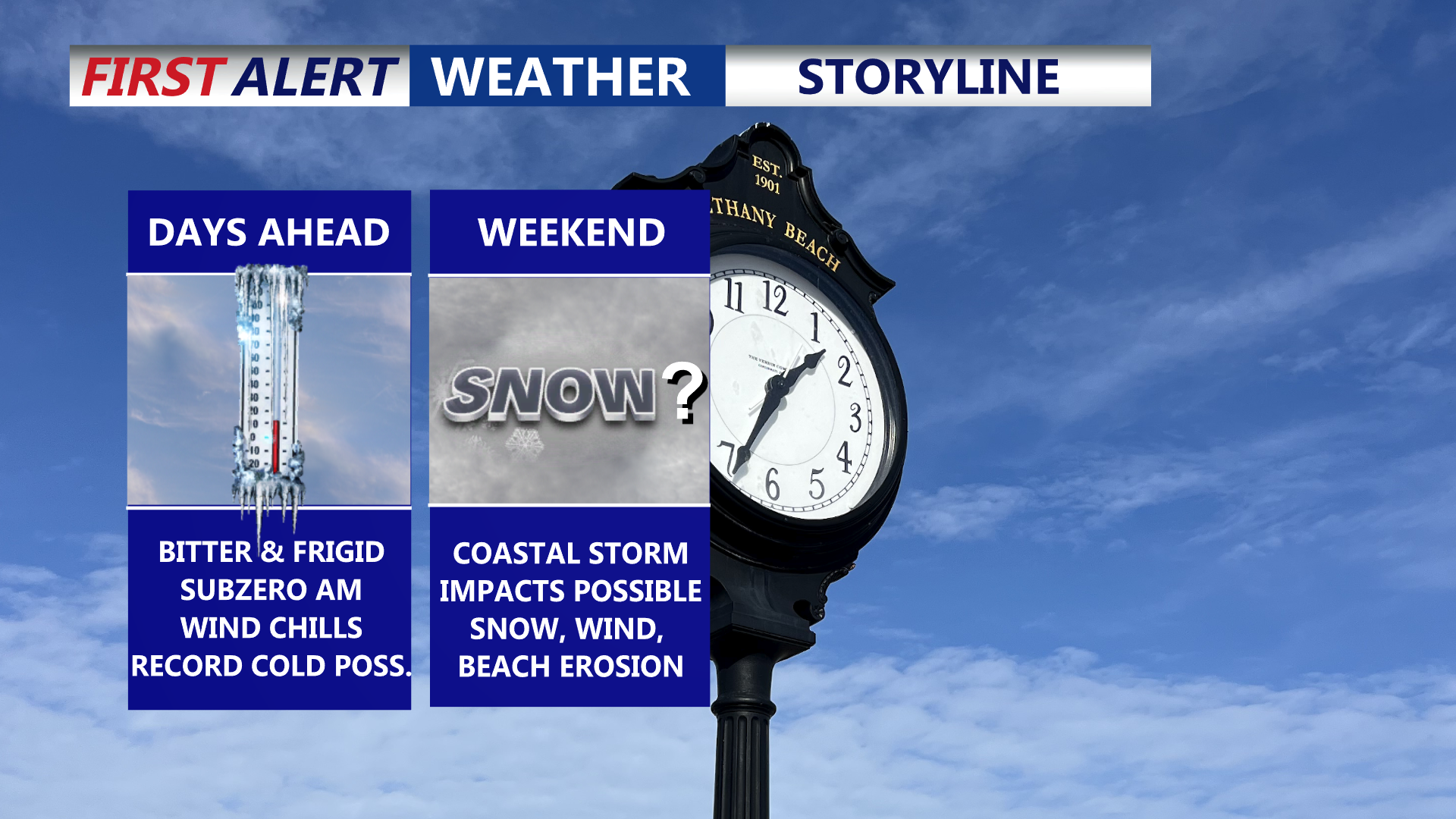

Delmarva is settling into a prolonged, dangerous stretch of cold through the end of the week, with daytime highs stuck in the 20s and overnight lows dropping into the single digits—creating wind chills below zero at times. Friday could challenge a record for the coldest high temperature. Attention then turns to a rapidly strengthening coastal storm this weekend that could bring snow, high winds, and coastal flooding, though the exact track (and impacts) remain uncertain.
From
To

Bitter cold conditions will grip Sussex County through Saturday night and Sunday, with lows in the teens and highs struggling to reach the mid-30s. Forecasters are monitoring a potential snowstorm expected to impact the area late Sunday night into Monday.

This weekend brings a noticeable cool down to Delmarva. High pressure builds in on Saturday, ensuring sunny skies but cooler temperatures struggling to get to 60. By Sunday, a warm front approaches, increasing clouds and bringing much-needed rain by late Sunday into Monday morning. Rainfall totals of 0.25-0.50 inches are expected, offering some relief to ongoing drought conditions. The week ahead looks dry and seasonable through midweek, with potential for a coastal low bringing more rain late next week.