


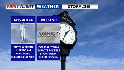
DELMARVA -- Under the grip of old man winter as we stay bitterly cold under partly cloudy skies. Highs reach the mid-20s, but it will feel closer to 12 to 18 degrees thanks to a stiff breeze and lingering arctic air.
A reinforcing shot of arctic air surges in tonight, keeping the region mostly clear and frigid. A brief snow shower can’t be ruled out this evening, but most spots stay dry. Overnight lows fall to 7 to 15 degrees across Delmarva. As winds continue, subzero wind chills are expected from tonight through Thursday morning, making it dangerous for anyone spending extended time outdoors.

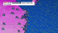
Wind Chills between -6 to 0 Thursday morning and Friday morning.
Mostly sunny skies Thursday, but it won’t help much. Expect mostly sunny skies with highs only in the low 20s, still well below freezing. Wind chills remain harsh early, improving slightly during the afternoon but staying very cold.
Friday the cold holds firm and conditions remain cold and dry. Subzero wind chills are likely again Friday morning. Friday afternoon could be unusually cold even by mid-winter standards—record cold high temperatures may be challenged. The current forecast high is 21 degrees, which is below the standing record of 24 degrees (set in 2010).
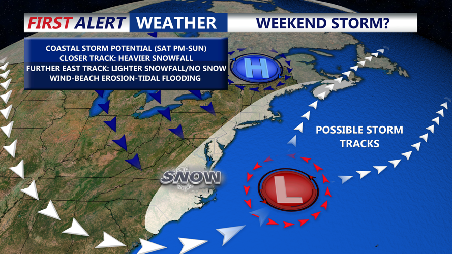
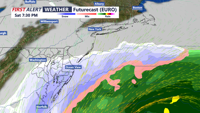
Beyond the deep freeze, there’s growing attention on a rapidly deepening storm expected to develop off the East Coast this weekend. Confidence in the storm’s exact track and details is still low, but the setup supports the potential for moderate to significant impacts in parts of the region.

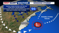
A coastal storm could bring accumulating snow, wind, beach erosion and tidal flooding to the peninsula late Saturday -Sunday.
Forecast models continue to show cyclogenesis beginning Saturday off the Southeast coast, with low pressure rapidly strengthening and lifting north and east Saturday night into Sunday, driven by a potent upper-level disturbance interacting with a strong coastal temperature contrast.

A powerful coastal storm will develop of the southeast coast Saturday, how close does it track to the coast will determine how high of an impact we see here on Delmarva. Snow/wind/coastal flooding.
What it means for us, impacts hinge on the storm track—still uncertain. Some guidance has shifted slightly west, while other model solutions remain farther east, and ensemble guidance still shows notable spread. In simple terms:
A closer, more northward coastal track would increase the risk of higher snow totals, stronger winds, and greater coastal flooding impacts.
A quicker turn east would likely keep the worst impacts offshore, resulting in more limited effects.
Timing: The earliest precipitation would arrive late Saturday, with the core of the storm Saturday night into Sunday if it tracks close enough.
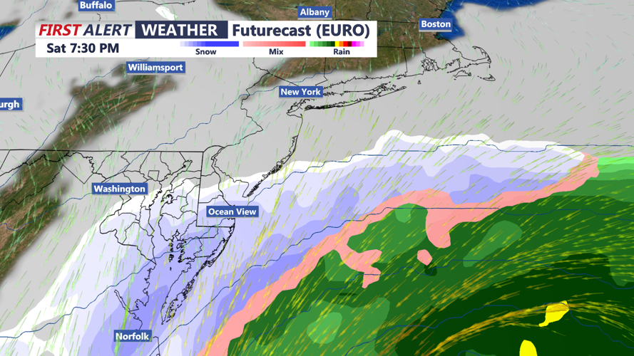
With very cold air in place at the surface and aloft, snow is strongly favored if precipitation reaches Delmarva.
Snow odds from probabilistic model guidance brings a chance of 2+ inches, roughly 40–50%, highest closer to the coast. Chance of 6+ inches roughly 30–40%, again higher near the coast.
Wind and coastal impacts: Even if snow totals end up lower, the storm may still track close enough to bring increasing winds Saturday night into Sunday morning. Current expectations point to N/NE winds 15–25 mph with gusts 25–35 mph inland, and 25–35 mph with gusts up to 50 mph along the coast. If the storm tracks closer than expected, winds could be even stronger—raising the risk for downed trees, power outages, and coastal flooding as water piles up along the shoreline.
Sunday night into early next week: The storm should pull away quickly by Sunday evening, with quieter but still cold weather expected early next week.