


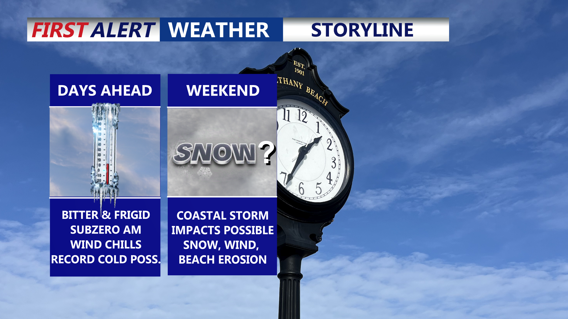

Delmarva is settling into a prolonged, dangerous stretch of cold through the end of the week, with daytime highs stuck in the 20s and overnight lows dropping into the single digits—creating wind chills below zero at times. Friday could challenge a record for the coldest high temperature. Attention then turns to a rapidly strengthening coastal storm this weekend that could bring snow, high winds, and coastal flooding, though the exact track (and impacts) remain uncertain.
From
To


For all the stories you missed this week, here is your Week In Review.

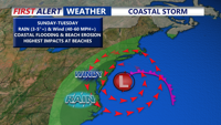
Delmarva is bracing for a powerful coastal storm expected to arrive late Saturday night, bringing heavy rain, strong winds, and significant coastal flooding through Monday. Sustained winds up to 40 mph and gusts near 60 mph+ along the coast, with widespread rainfall of 1 to 3 inches and higher amounts possible. The storm could lead to beach erosion, dune breaches, power outages, and dangerous coastal conditions before improving weather returns by Tuesday.

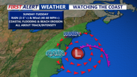
High pressure will keep Delmarva sunny and seasonable through Friday before shifting offshore. Clouds and mild temperatures return Saturday ahead of a developing coastal storm expected to bring heavy rain, damaging winds, and coastal flooding beginning late Saturday night through Monday. Forecast confidence is increasing for significant impacts along the Atlantic coast, including beach erosion and water rise concerns.

A stalled front and incoming low pressure will bring widespread rain to Delmarva Sunday night into Monday. Expect up to 1.5 inches of rainfall, a sharp temperature drop, and gusty winds by midweek. After a brief dry spell, unsettled weather returns late Thursday into the weekend, with a chance of a nor’easter developing by Saturday.


A powerful storm system will bring heavy rain, strong winds, and the potential for isolated severe weather to parts of Delmarva this weekend. Rain arrives Saturday afternoon, with temperatures rising overnight into the 60s by Sunday morning. A strong cold front will bring another round of heavy rain and possible thunderstorms Sunday afternoon, with wind gusts up to 60 mph. A sharp drop in temperatures follows, with wind chills in the teens Monday morning. Arctic air will settle in for much of next week ahead of a possible coastal storm Wednesday into Thursday, which could bring accumulating snow to the region.

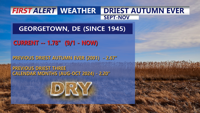
Georgetown, Delaware, closes November with record-breaking drought conditions as the driest autumn on record adds to an already significant rainfall deficit. November was slightly warmer than average, but a lack of precipitation remains the region's top concern, with rainfall totals nearly 8.5 inches below average for the year. December is forecast to continue the dry trend, further challenging the area.