


DELMARVA -- A dynamic storm system will impact Delmarva this weekend, bringing periods of heavy rain, strong winds, and a sharp temperature drop heading into Presidents' Day.

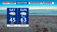
Weekend Planner
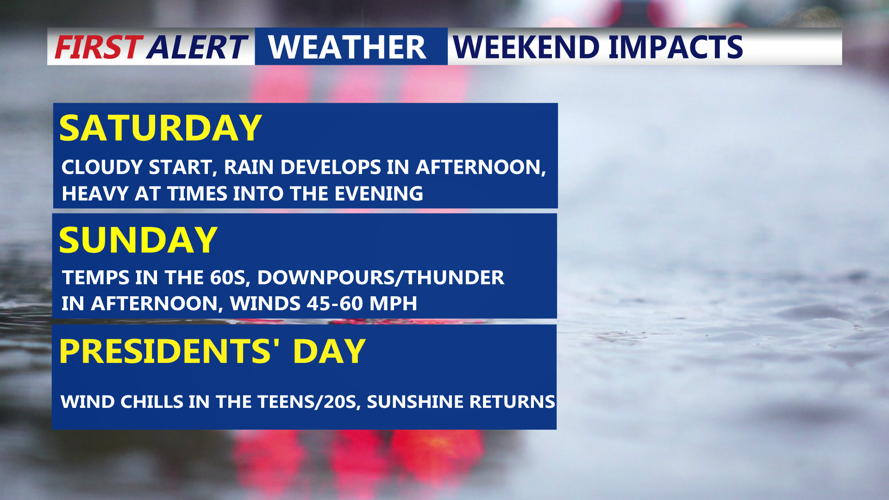
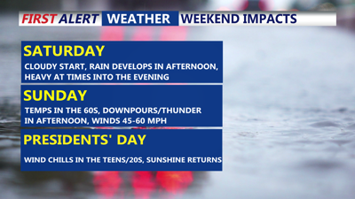
Low pressure developing in the Mississippi Valley will rapidly strengthen as it moves toward Pennsylvania by early Sunday. Rain will develop Saturday afternoon, becoming heavy at times through the evening. Highs will reach the mid 40s, however temperatures will rise into the 50s overnight as a warm front lifts north, climbing into the 60s by Sunday morning. We have issued a Red Alert for Sunday.

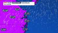
A strong cold front will push through Sunday afternoon, bringing another round of heavy rain and a few thunderstorms. Wind gusts could reach 45 to 60 mph, with the highest risk along coastal areas such as Ocean City, Assateague, and Chincoteague.

Gusts as high as 45 to 60 mph are possible.
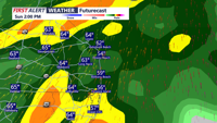
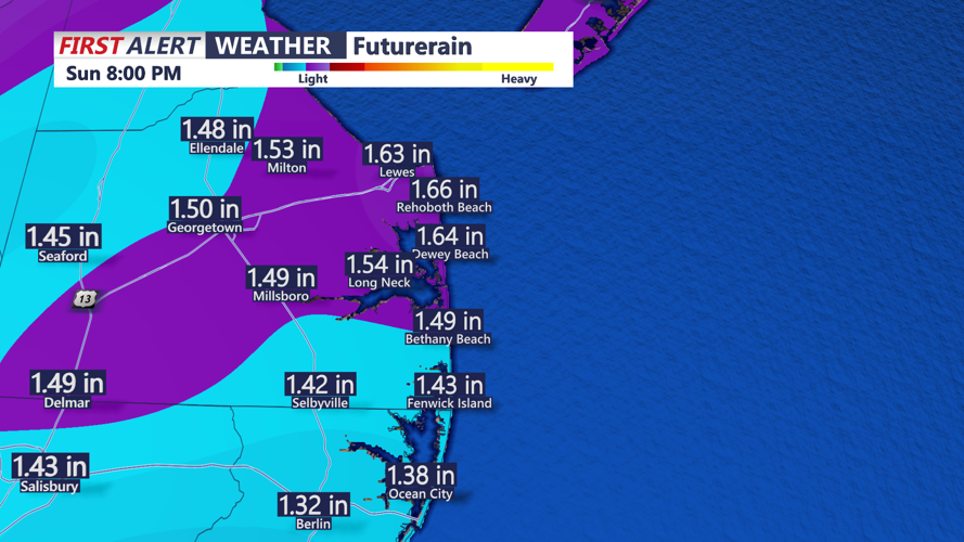
The Storm Prediction Center has placed southern Delmarva under a "marginal" risk for isolated damaging winds. Rainfall totals from Saturday through Sunday night are expected to range between 1 to 2 inches across the region.

Forecasted Rainfall Saturday Through Sunday
Following the cold front’s passage, winds will shift out of the northwest, ushering in much colder air. By Monday morning, wind chills will be in the teens, a stark contrast to Sunday’s warmth. Highs will struggle to reach the 30s early next week, with some areas in northern and western Delmarva staying in the 20s.
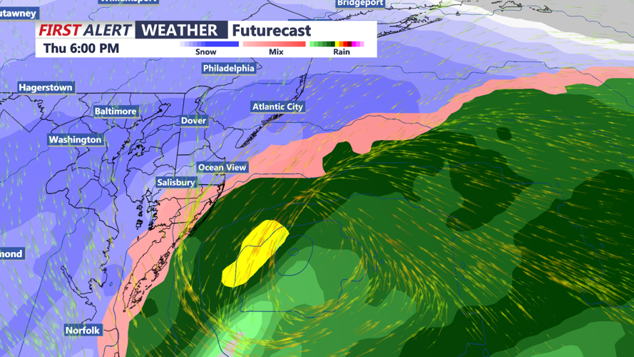
We are closely monitoring the possibility of a coastal storm developing Wednesday night into Thursday. While details remain uncertain, accumulating snow is possible across the region as cold air will already be in place.

A potential nor'easter is possible Wed Night - Thursday.
Once the midweek storm clears, colder temperatures will persist into the weekend, with highs remaining in the 30s and 20s in northern and inland areas.
Stay with the COAST TV First Alert Weather team for updated forecast through the weekend.
