Thunderstorms - some locally heavy downpours are possible, especially during the afternoon hours. High 83F. Winds SW at 10 to 15 mph. Chance of rain 100%. Locally heavy rainfall possible..
Tonight
Partly cloudy skies this evening will become overcast overnight. Low 71F. Winds N at 5 to 10 mph.
Chris Mastrobuono is a South Philly native, but has come to join
the CoastTV meteorology team. Chris has over three years of
experience delivering weather analysis. Previously, he spent over
two years as a morning meteorologist at WEVV CBS/FOX in Evansville,
Indiana.
DELMARVA -- A period of relative calm will settle over Delmarva today and tonight before a significant coastal storm develops and impacts the region by late weekend. High pressure currently centered over interior New England will drift offshore this afternoon, ushering in onshore flow and moderating temperatures into the mid to upper 60s.
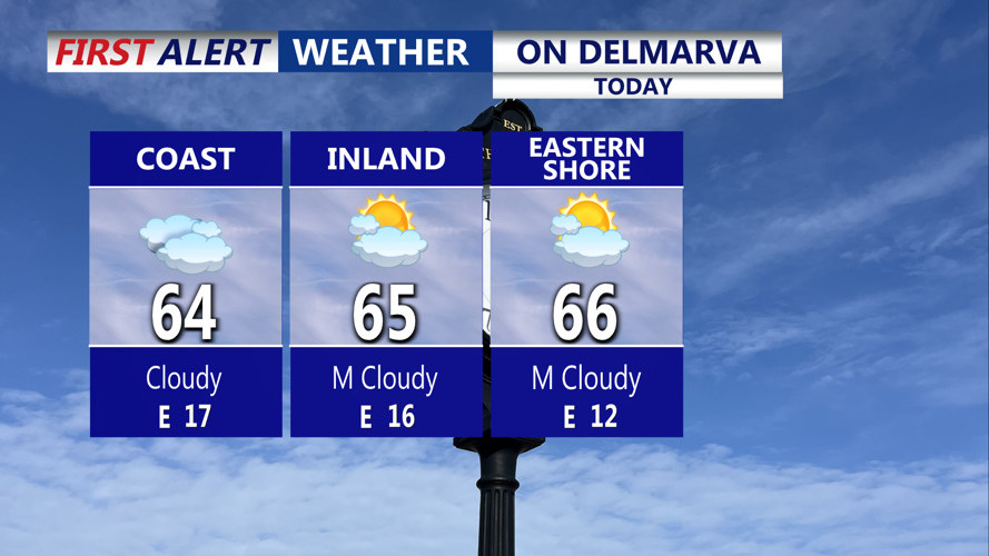
Partly sunny cool Friday with highs in the mid to upper 60s, breezy east winds at the beaches gusting 25 mph.
Skies will become increasingly cloudy through the day, but any cloud cover will remain mostly harmless. Overnight lows will hold steady in the upper 40s to mid-50s as moisture builds and clouds thicken.
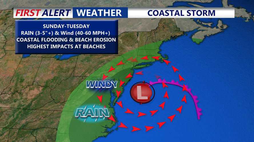
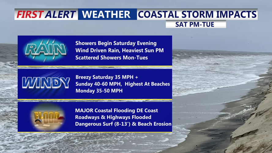
Rain begins late Saturday, worst of the storm impacts Delmarva Sunday, could linger into Tuesday.
Saturday will see mostly cloudy to overcast skies with temperatures climbing into the upper 60s and low 70s. While the day should remain mostly dry, scattered showers may begin to develop late in the afternoon. Winds will shift from the east and start to strengthen, especially near the coast.
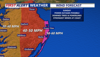
Expecting the highest wind gusts at the beaches, gusts 50-60 mph.
Conditions will deteriorate Saturday night as a developing coastal low-pressure system off the Carolinas moves northward. Rain chances increase sharply and winds will strengthen significantly, with gusts near 40 to 50 mph possible along coastal areas by Sunday morning.
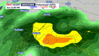
Potentially significant impacts from a powerful coastal storm Sunday through Monday. The storm is expected to track northward along a stalled frontal boundary, possibly making landfall over Delmarva or passing just offshore.
The strongest winds and heaviest rainfall are expected along the Atlantic coastline. Sustained winds between 30 and 40 mph, with gusts reaching 60 to 70 mph, are possible by Sunday afternoon and into early Monday. A High Wind Watch is already in effect for Sussex County, where damaging winds, downed trees, and power outages are likely. Inland areas may also see strong winds and advisories as the system evolves.
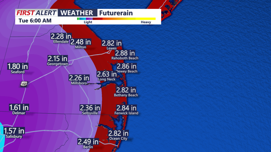
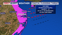
Heavy rain is forecast across the region, with widespread totals of 1 to 3 inches and localized amounts up to 5 inches possible, particularly near the coast. The greatest flood risks will occur in poor drainage and urban areas, though prolonged rainfall could worsen coastal flooding. Strong northeast winds and high tides will pile water against the shoreline, causing beach erosion, dune breaches, and potentially major coastal flooding.
The storm’s exact track remains uncertain, with two primary scenarios still possible. A closer coastal track could bring more severe impacts, while a path farther offshore could lessen, but not eliminate, significant effects. The system’s evolution will depend on several atmospheric factors, including interactions with high pressure to the north, an upper-level low over the Great Lakes, and even distant Tropical Storm Jerry.
The storm is expected to weaken significantly by Tuesday, though lingering showers and breezy conditions may persist as the remnant low drifts offshore. By mid- to late week, high pressure will rebuild over the region, bringing cooler, drier weather with below-normal temperatures and fair skies.
Residents and visitors across Delmarva are urged to monitor forecast updates closely over the next 48 hours and prepare for potentially dangerous coastal conditions, flooding, and power outages as the storm approaches.
Chris Mastrobuono is a South Philly native, but has come to join
the CoastTV meteorology team. Chris has over three years of
experience delivering weather analysis. Previously, he spent over
two years as a morning meteorologist at WEVV CBS/FOX in Evansville,
Indiana.