


DELMARVA -- High pressure remains firmly in control across Delmarva today, bringing wall-to-wall sunshine and comfortable fall conditions. Skies will stay clear as the strong Canadian high, now centered over the eastern Great Lakes, shifts eastward and settles over southern New England tonight.

Mostly sunny and about 5 to 10 degrees below average, breezy northwest winds gusting 20-25 mph.
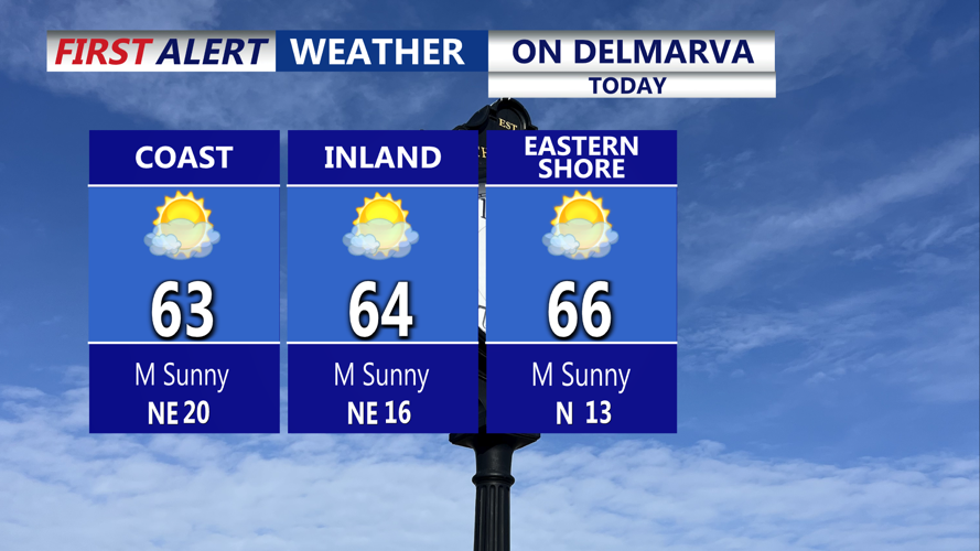
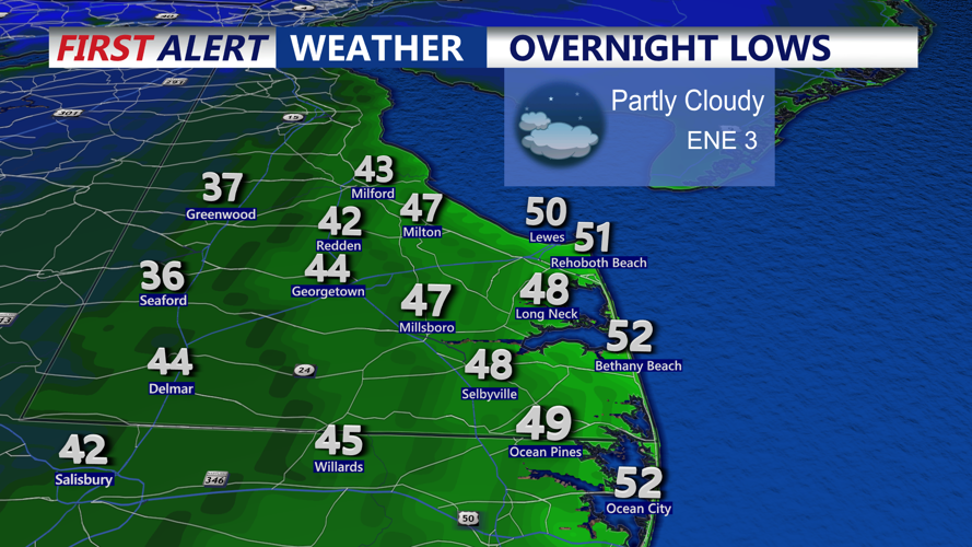
Winds will remain light to moderate at 5 to 15 mph, with gusts reaching up to 25 mph along the coast. Afternoon highs will reach the low to mid-60s, while tonight’s lows will dip into the upper 30s inland and mid-40s near the shore. Patchy frost may form away from the coast, though some low clouds could develop overnight as winds turn more onshore.

Some inland patchy frost is possible, western Sussex, western Kent and the mid-shore.
Friday continues the quiet trend with mostly sunny skies and highs in the mid-60s. The high pressure system will shift offshore, allowing milder air and onshore flow to develop. Clouds will increase later in the day, with overnight lows staying in the 40s and low 50s.

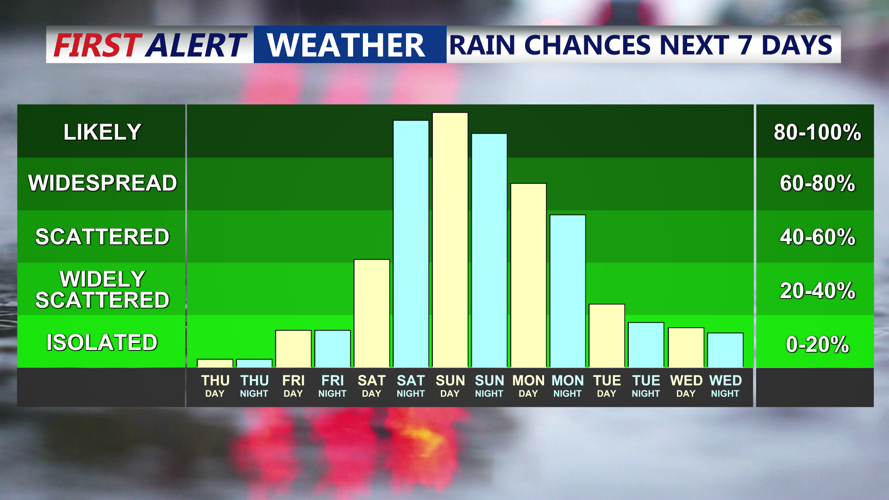
Rain chances ramp up late Saturday, all day Sunday through Monday ahead of a coastal storm.
By Saturday, conditions will turn noticeably more humid and overcast. Temperatures will climb into the upper 60s to low 70s, and a few isolated showers may appear along the coastal plain by the afternoon. Winds will strengthen out of the east later in the day as a developing coastal low begins moving northward from the Carolinas.
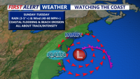
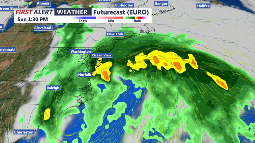
Significant Impacts Expected by Sunday
The calm weather will take a sharp turn Saturday night as a potentially powerful coastal storm approaches Delmarva. Rain will begin spreading northward overnight, becoming heavy at times by Sunday. Winds will also increase dramatically, with sustained speeds of 30 to 40 mph and gusts possibly exceeding 60 mph along the coast. Inland areas could see gusts near 40 to 50 mph.

Coastal storm expected to impact Delmarva late this weekend, the brunt of the storm coming through Sunday.
The Weather Prediction Center has highlighted a Slight Risk (Level 2 of 4) for excessive rainfall across Delmarva Sunday into Sunday night. Rainfall totals of 1 to 2 inches are expected, with localized areas potentially reaching 3 to 5 inches.
Strong northeast winds will also pile water along the coast, bringing a risk of moderate to major coastal flooding and beach erosion through Sunday and Monday.
While forecast details remain uncertain, the exact track of the storm will determine how severe the impacts are across Delmarva. A closer coastal track would bring stronger winds and higher rainfall totals, while a more offshore path could lessen—but not eliminate—hazards.
Conditions should gradually improve by Tuesday as the system moves away, leaving behind seasonable and quieter weather for mid-October.