


DELMARVA -- A stretch of damp and chilly weather as a stalled frontal boundary to the south teams up with multiple low-pressure systems to keep the region soaked and cloudy through Monday. A stronger cold front arriving Monday night will drastically drop temperatures, making way for a blustery and colder pattern through midweek.
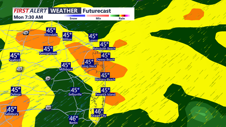
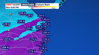
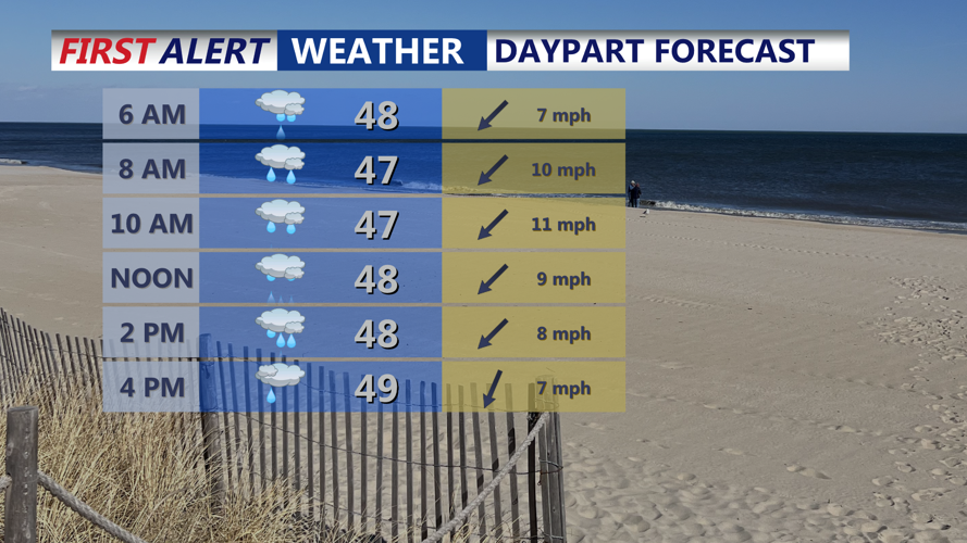
Widespread rainfall is expected to develop Sunday night as a weak low-pressure system rides along the stationary front. Rain is most likely between 2 a.m. and 8 a.m. Monday, when modest isentropic lift will peak. We have issued a YELLOW ALERT for the rainfall we are expecting into Monday. Rainfall totals of 1.00 to 1.50 inches are forecast across the region, though localized heavier downpours and even a few rumbles of thunder are possible near the coast due to slight elevated instability.

Rainfall totals 1 to 2 inches through Monday evening.
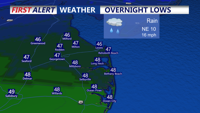
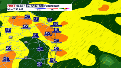
Temperatures will cool quickly overnight, with lows dipping into the mid to upper 40s by Monday morning—about 10 degrees cooler than the previous night.

Rain overspreads Delmarva Sunday Night into Monday morning.
Highs on Monday are expected to struggle into the upper 40s to near 50 degrees, especially with rain lingering along the coast through the afternoon.

Periods of rain Monday, heavy at times, cool and raw.
By late Monday night, a cold front will sweep through Delmarva between midnight and 4 a.m., clearing out the rain and ushering in much colder, drier air. Northwest winds will pick up between 10–20 mph, with gusts up to 30 mph possible overnight into Tuesday morning.
Tuesday will feel notably colder, with highs in the 40s, wind chills stuck in the 30s, and gusts as high as 40 mph due to a deepening low over New England. Though no wind advisories are currently planned, soggy soils combined with strong gusts may result in isolated tree damage or power outages.

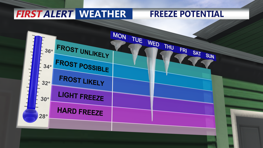
Freeze looking likely Tuesday night into Wednesday morning.
A widespread freeze is expected Tuesday night, with lows in the mid-20s to near 30 degrees—even along the coast. Wind chills could bottom out near 20 degrees, marking the coldest night of the week.
Wednesday will be sunnier, though temperatures remain on the chilly side, with highs struggling into the upper 40s to near 50 degrees. Winds will ease to 10–15 mph, but it will remain brisk under dry, Canadian high pressure.
After a quiet Wednesday night, conditions begin to change Thursday as high pressure moves offshore and a new low-pressure system develops in the Midwest, sliding toward the East Coast. Moisture from a warm front may reach Delmarva late Thursday or Friday, triggering another round of showers or steady rain into Saturday.
Forecast models hint at the potential for this low to become a closed-off nor’easter by Saturday morning, either over or just offshore of the Mid-Atlantic. While specifics remain uncertain, periods of rain and gusty onshore winds are possible into Saturday, depending on the storm’s exact track. Conditions should start to improve by Sunday, with PoPs (precipitation chances) tapering to 30% or less.