


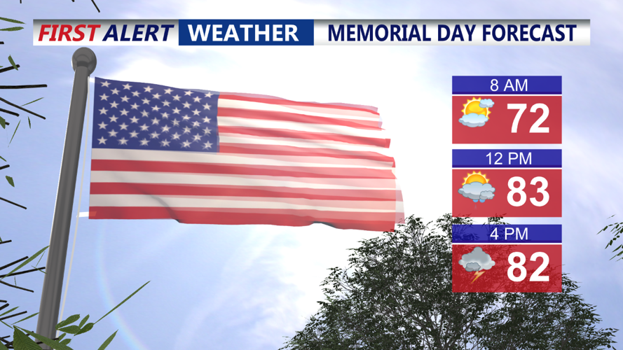


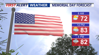
DELMARVA- We started our Memorial Day with a few showers and thunderstorms, with a bigger coverage of storms expected this afternoon and evening, and severe weather possible.
A warm and muggy airmass is in place ahead of a strong cold front. Expect temperatures to rise into the low to mid 80s later this morning and afternoon, with some cooler readings at the beaches. If you're out and about for Memorial Day we should see dry conditions through early afternoon.

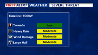
By mid-afternoon keep an eye to the sky for darkening conditions. Showers and thunderstorms are expected to develop across the region after 3 pm. Make sure to have a plan b in the event of severe weather. Any outdoor items like lawn furniture, umbrellas, or lawn ornaments should be secured or brought inside. We could see damaging winds in excess of 50 mph. In addition to that, torrential rain with local flooding, and large hail is possible as well. An isolated tornado or two can't be ruled out. Make sure you download the Coast TV Weather App and stay updated with the forecast.
Storms move out later this evening, with gradual clearing overnight and lows in the mid 60s by morning.
Tuesday will be a much nicer day with lots of sunshine and lower humidity with temperatures in the low to mid 80s. Tuesday night we'll see mainly clear skies and lows near 60.
Wednesday we could see a few more showers with another cold front with highs near 80.
The rest of the week is drier with comfortable humidity levels with highs in the 70s and lows in the 50s.