


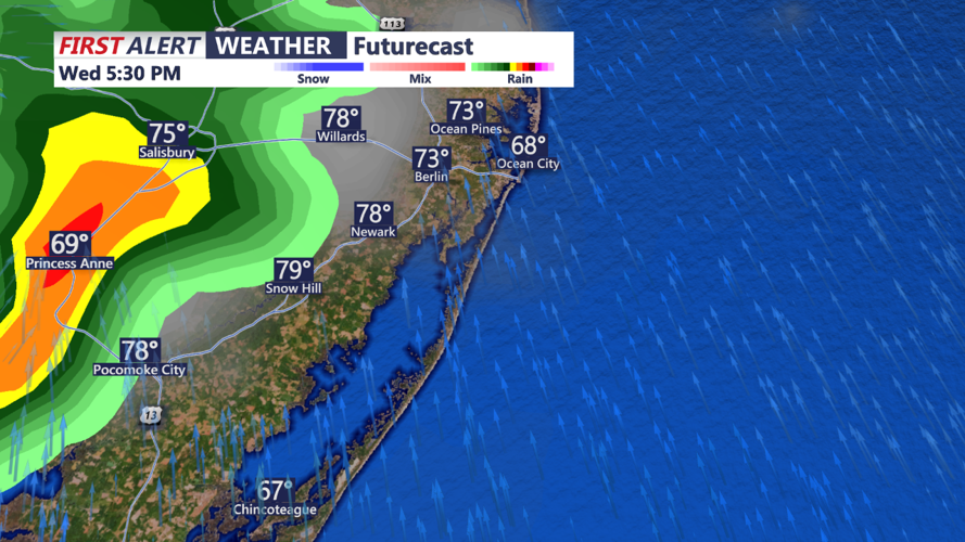

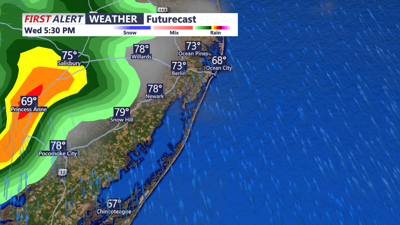
DELMARVA- A cold front approaches the region from the northwest Tuesday night and Wednesday. The cold front is expected to move through later on Wednesday into Wednesday night before moving offshore.
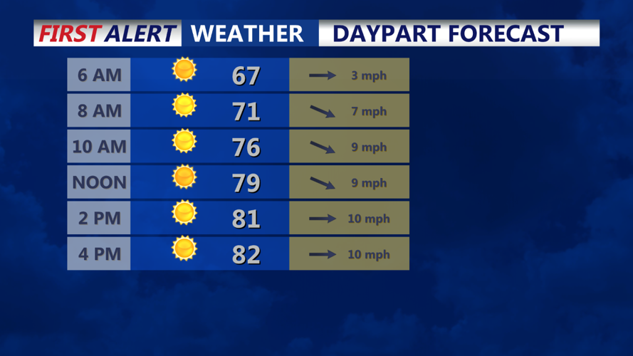
Surface high pressure will build in thereafter, holding influence over the region from Thursday into Sunday. Unsettled conditions could return late weekend into the beginning of next week, thanks to the next low pressure system and associated fronts.

Unsettled conditions could return late weekend into the beginning of next week, thanks to the next low pressure system and associated fronts.
A few isolated showers and perhaps a thunderstorm are possible Tuesday afternoon across Delmarva, as a weak secondary frontal boundary moves through the region. The severe threat will be minimal with very limited instability in place despite modest deep layer shear. While temperatures will not be much cooler behind the front, a much drier air mass will overspread the region with surface dew points falling into the 50s. Winds will remain elevated through sunset Tuesday night with gusts around 25 mph.